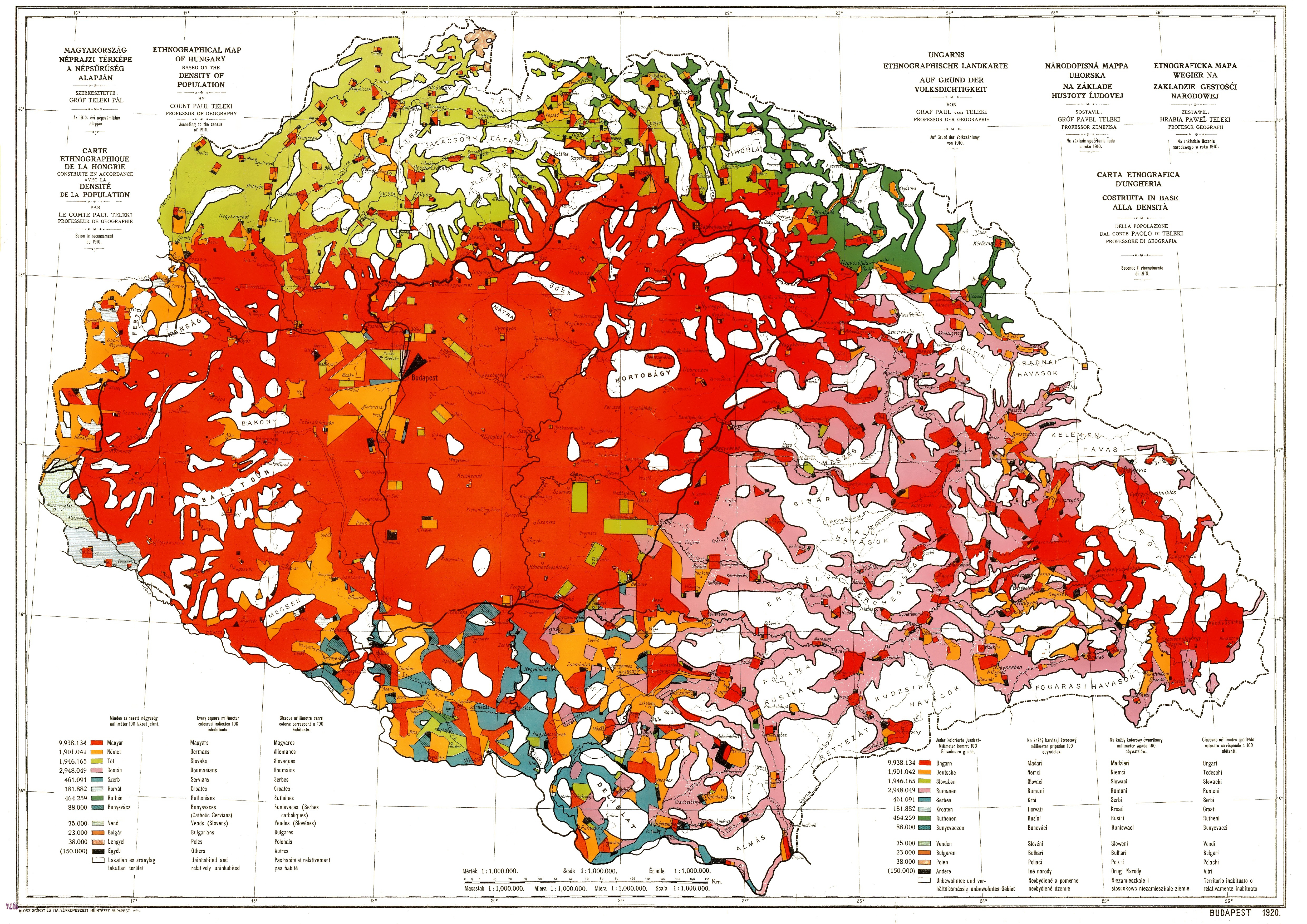
Ethnographic map of hungary 1910 by teleki carte rouge
Autor:
Credit:
Scanned from an original
Krótki link:
źródło:
Wymiary:
4962 x 3509 Pixel (5436625 Bytes)
Opis:
Ethnographic map of Hungary, based on the density of population according to the census of 1910. Original scale 1 : 1 000 000. Every square millimeter colored indicates 100 inhabitants. "Carte Rouge" - "Red map" was made for the peace talk in Trianon.
Licencja:
Public domain
Więcej informacji o licencji można znaleźć tutaj. Ostatnia aktualizacja: Tue, 06 Sep 2022 16:51:02 GMT