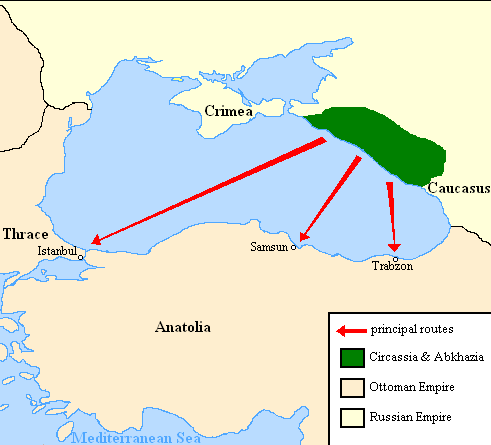
Expulsion map of the Circassians in 19th century
Autor:
Credit:
Praca własna
Krótki link:
źródło:
Wymiary:
491 x 445 Pixel (15418 Bytes)
Opis:
Map showing the location of Circassia and the expulsion routes (1859-1864) of the Circassians and other Caucasian peoples to the Ottoman Empire, after the Russian annexation of the North-Caucasus following the Crimean War of 1853-1856.
I used the information of the following two maps:
http://www.circassianworld.com/CIRCASSIA1840.jpg
And the books: The Northwest Caucasus: past, present, future, Walter Richmond
The forgotten minorities of Eastern Europe, Arno Tanner
Licencja:
Public domain
Więcej informacji o licencji można znaleźć tutaj. Ostatnia aktualizacja: Wed, 30 Nov 2022 04:14:38 GMT