Hellas MOLA zoom 64 small
Autor:
NASA / JPL-Caltech / Arizona State University
Credit:
Krótki link:
źródło:
Wymiary:
5600 x 5000 Pixel (10513779 Bytes)
Opis:
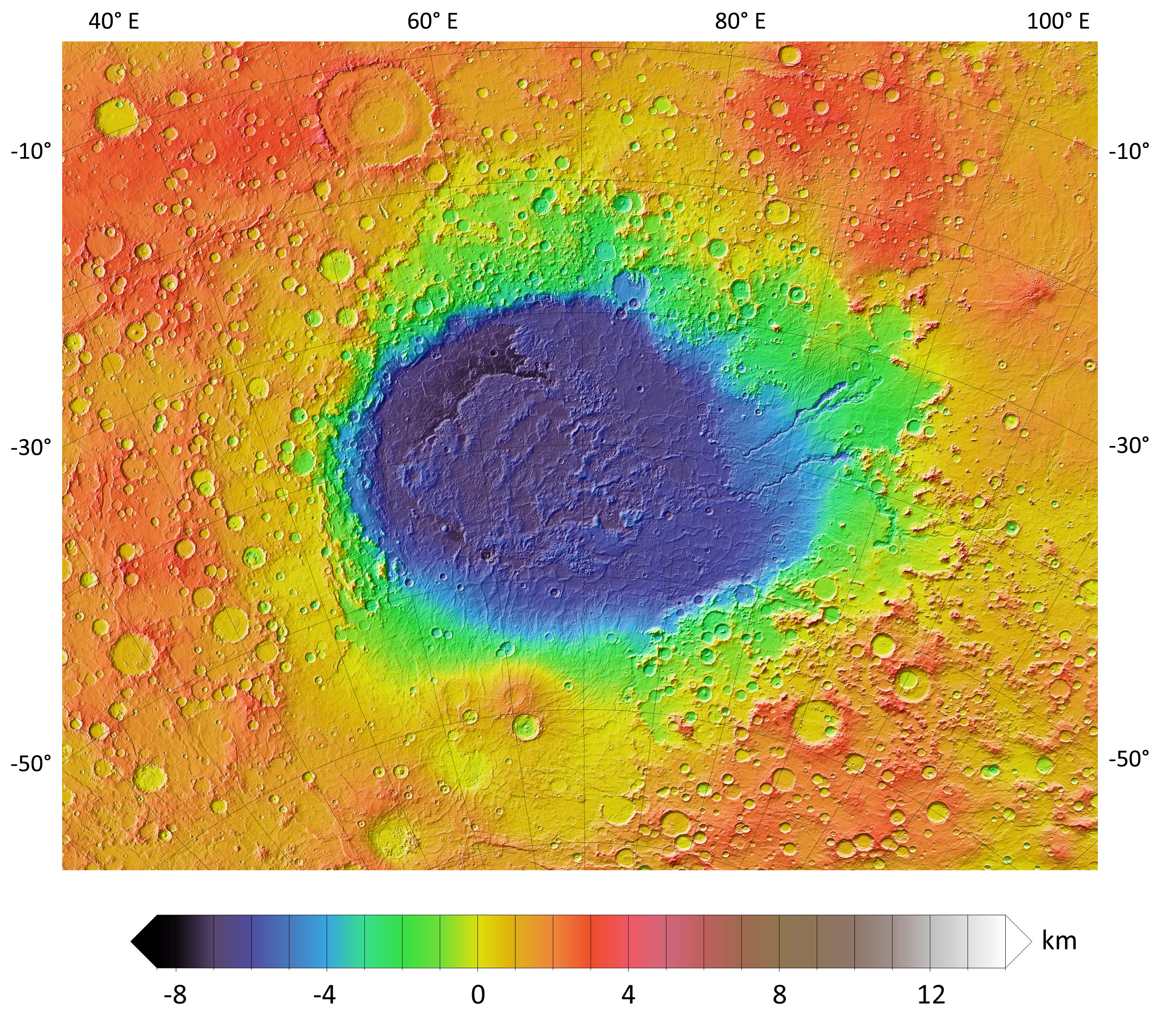
A colorized topographic map of the martian impact basin Hellas, together with its surroundings, from the Mars Orbiter Laser Altimeter (MOLA) instrument of the Mars Global Surveyor spacecraft. Hellas, the deepest basin on Mars, lies in the southern hemisphere, south of Syrtis Major Planum.
Licencja:
Public domain
Więcej informacji o licencji można znaleźć tutaj. Ostatnia aktualizacja: Sun, 21 Aug 2022 15:52:43 GMT