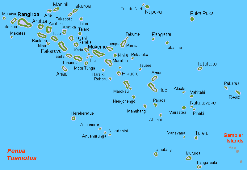
Karta FP Tuamotus isl
Autor:
Hobe / Holger Behr
Credit:
Praca własna
Krótki link:
źródło:
Wymiary:
800 x 550 Pixel (11803 Bytes)
Opis:
Map (rough) of the Tuamotus Islands, French Polynesia, own work composed from various mapreferences
Licencja:
Public domain
Więcej informacji o licencji można znaleźć tutaj. Ostatnia aktualizacja: Thu, 31 Mar 2022 20:46:08 GMT