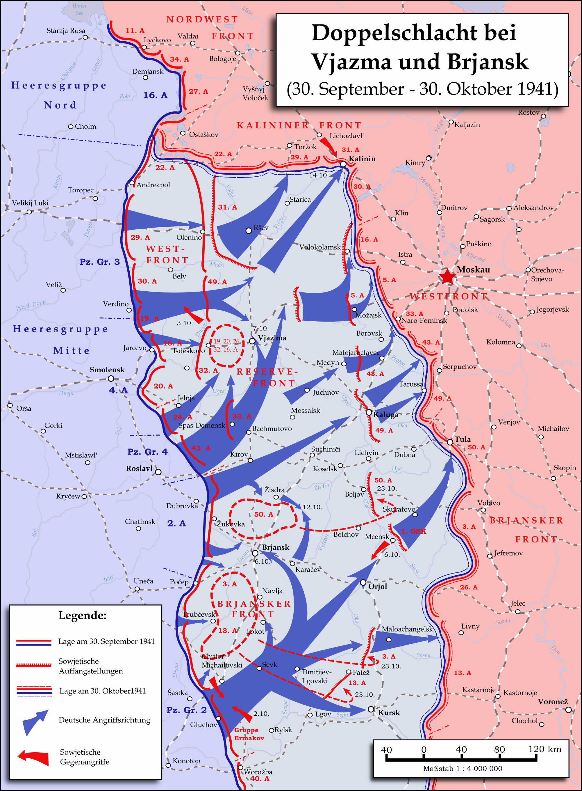
Karte - Kesselschlachte bei Vjazma und Brjansk 1941
Autor:
Attribution:
Obraz jest oznaczony jako „Wymagane uznanie autorstwa” (attribution required), ale nie podano żadnych informacji o uznaniu autorstwa. Prawdopodobnie parametr atrybucji został pominięty podczas korzystania z szablonu MediaWiki dla licencji CC-BY. Autorzy mogą znaleźć tutaj przykład prawidłowego korzystania z szablonów.
Credit:
Praca własna
Krótki link:
źródło:
Wymiary:
2002 x 2718 Pixel (1637251 Bytes)
Opis:
Map showing the two battles near Vyazma (October 2nd — October 20th 1941) and Brjansk (September 30th - October, 23rd) during the Second World War (1939—1945) at the Eastern Front. The map was created in Inkscape and is based on Map 30 in the attachment of the book P.N. Pospelow (Hrsg.): Geschichte des Großen Vaterländischen Krieges der Sowjetunion, Bd. 2, Berlin (Ost) 1963. The troop movements have been corrected.
Licencja:
Warunki licencji:
Creative Commons Attribution 3.0
Więcej informacji o licencji można znaleźć tutaj. Ostatnia aktualizacja: Fri, 13 Jan 2023 11:01:13 GMT