Kiribati map LOC
Autor:
US Dept of Congress, 1989
Krótki link:
źródło:
Wymiary:
2399 x 1943 Pixel (757682 Bytes)
Opis:
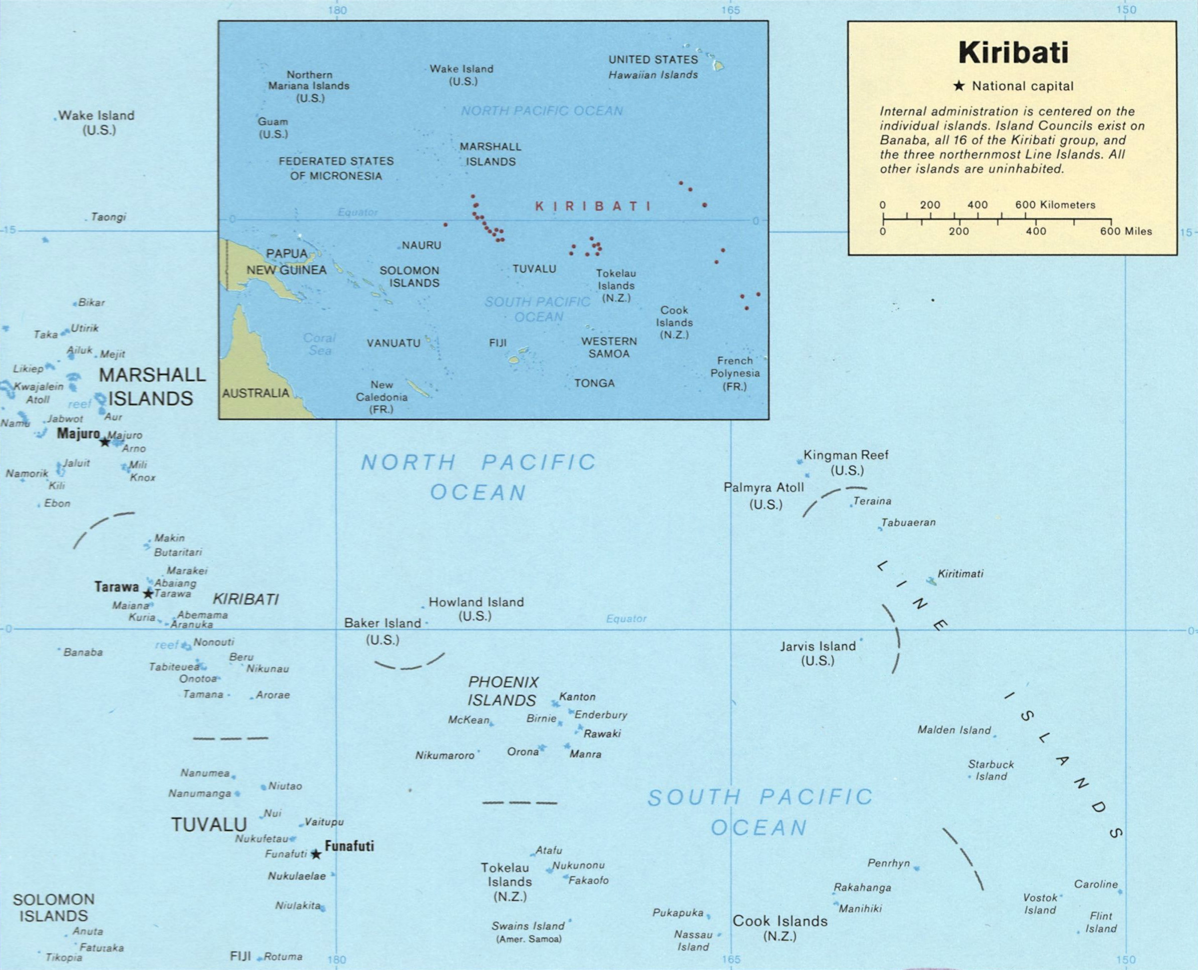
Map of Kiribati
Licencja:
Public domain
Komentarz do licencji:
This United States Congress image is in the public domain. This may be because it was taken by an employee of the Congress as part of that person’s official duties, or because it has been released into the public domain and posted on the official websites of a member of Congress. As a work of the U.S. federal government, the image is in the public domain.
Więcej informacji o licencji można znaleźć tutaj. Ostatnia aktualizacja: Sat, 08 Oct 2022 19:12:10 GMT