Limpopo
Autor:
TSgt Cary Humphries
Credit:
Ten szablon nie wskazuje stanu prawnego pliku. Standardowy szablon licencji jest nadal wymagany. Aby dowiedzieć się więcej, zajrzyj na stronę Commons:Licencja.
Krótki link:
źródło:
Wymiary:
1681 x 1105 Pixel (545514 Bytes)
Opis:
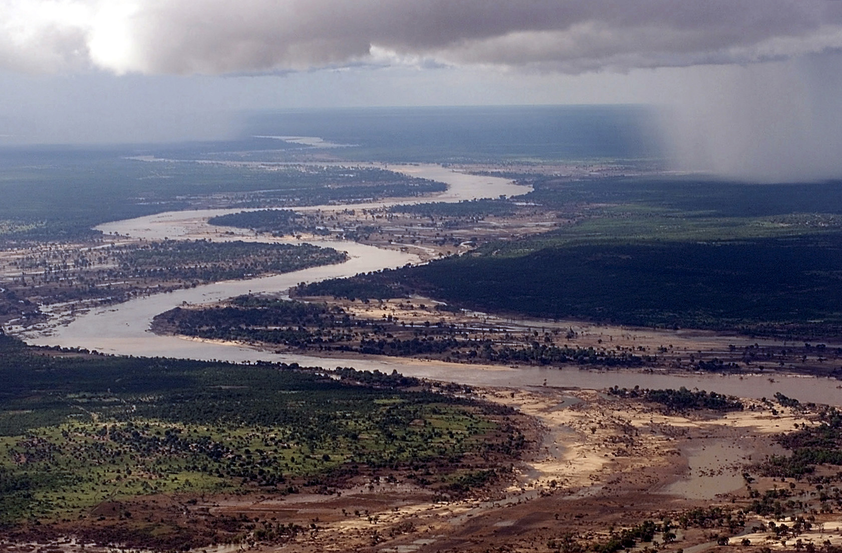
Aerial view, extreme long shot, looking down as the Limpopo River winds its way through Southern MOZAMBIQUE, where it recently crested its banks and sent floodwaters rushing through towns and farmland, forcing people from their homes and wreaking havoc with the country's infrastructure. Even though waters have receded over the past week, heavy rains seen in the distance, continue to threaten the region with more flooding. C-130 aircraft (not shown), assigned to the 37th Airlift Squadron at Ramstein Air Base, Germany, fly daily Keen Sage aerial surveillance missions over MOZAMBIQUE to rescue stranded flood victims and survey flood levels and damage caused by the flooding in Southern Africa. The 37th Airlift Squadron C-130 aircraft, deployed to Hoedspruit Air Force Base, South Africa, is part of the United States Operation Atlas Response humanitarian relief efforts.
Licencja:
Public domain
Komentarz do licencji:
Ta grafika została utworzona przez pracownika Sił Zbrojnych lub Departamentu Obrony Stanów Zjednoczonych podczas wykonywania czynności służbowych. Jako utwór Rządu Federalnego Stanów Zjednoczonych, grafika ta znajduje się w domenie publicznej.
Więcej informacji o licencji można znaleźć tutaj. Ostatnia aktualizacja: Fri, 23 Sep 2022 12:55:06 GMT