Liverpool Overhead Railway map
Autor:
OpenStreetMap-Contributors, Metrophil
Attribution:
Obraz jest oznaczony jako „Wymagane uznanie autorstwa” (attribution required), ale nie podano żadnych informacji o uznaniu autorstwa. Prawdopodobnie parametr atrybucji został pominięty podczas korzystania z szablonu MediaWiki dla licencji CC-BY. Autorzy mogą znaleźć tutaj przykład prawidłowego korzystania z szablonów.
Credit:
Krótki link:
źródło:
Wymiary:
2500 x 5604 Pixel (3658132 Bytes)
Opis:
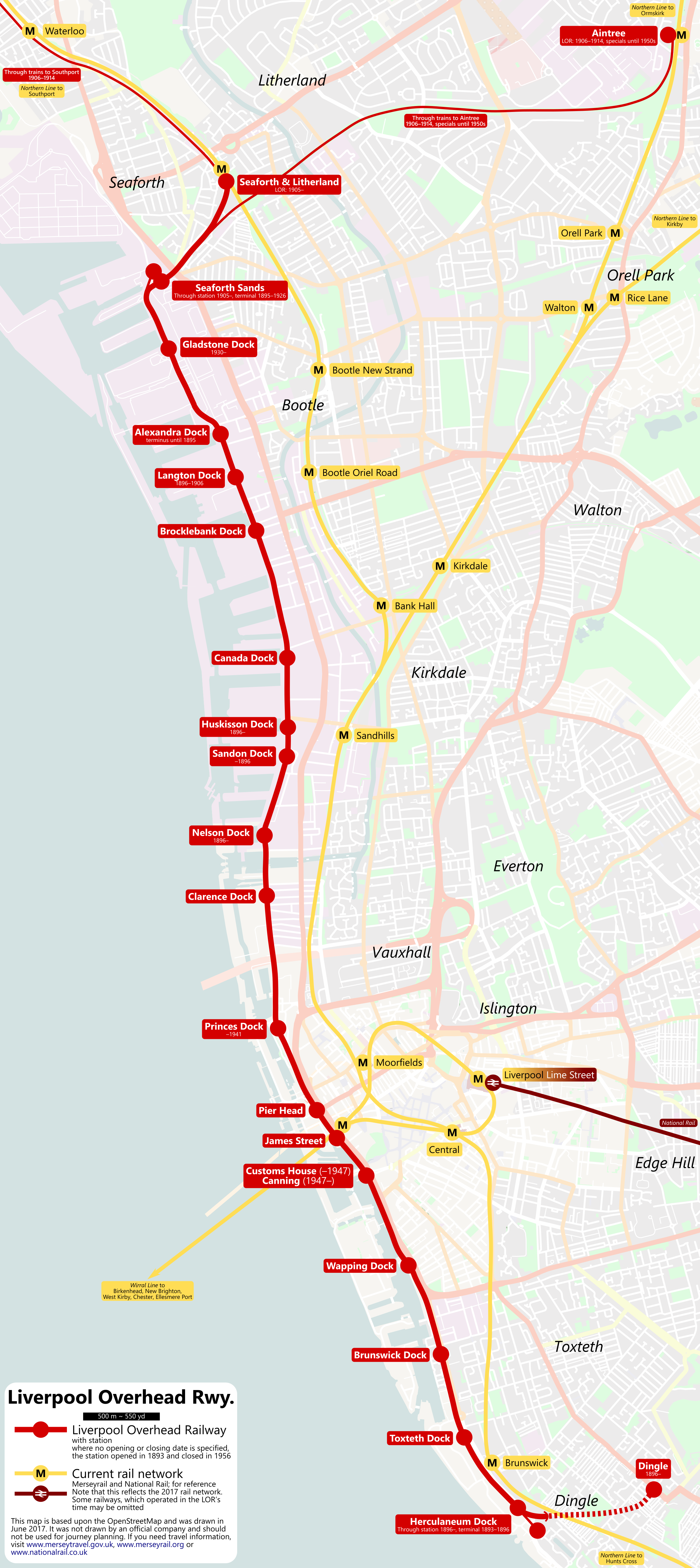
Geographical map of the Liverpool Overhead Railway. For reference, the current Liverpool rail network (Merseyrail and National Rail) is also shown. Of the LOR stations, the opening and closing date, if it is not the line’s overall opening in 1893 and closing in 1956, are noted beneath the station name.
Note, because it is not relevant for a LOR map, the Birkenhead area has been omitted.
Licencja:
Warunki licencji:
Creative Commons Attribution-Share Alike 2.0
Więcej informacji o licencji można znaleźć tutaj. Ostatnia aktualizacja: Sat, 16 Oct 2021 12:58:39 GMT