LuxembourgPartitionsMap francais
Autor:
Credit:
Modification of the image  from QuartierLatin1968 (2005-04-22 14:10 (UTC))
Krótki link:
źródło:
Wymiary:
433 x 588 Pixel (113431 Bytes)
Opis:
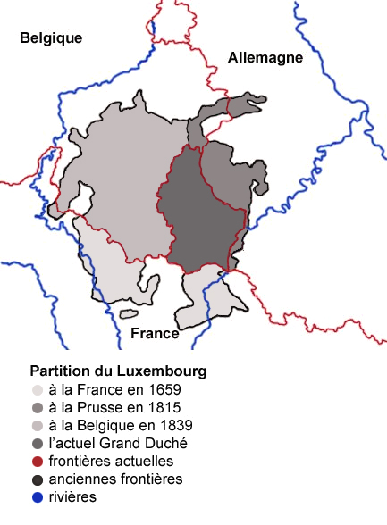
Map showing the partition of Luxembourg through the centuries, with French explanations.
Licencja:
Public domain
Więcej informacji o licencji można znaleźć tutaj. Ostatnia aktualizacja: Wed, 14 Dec 2022 23:10:38 GMT