Luxembourg administrative subdivisions coloured
Autor:
Credit:
Own work based on w:Image:Luxembourg.geohive.gif, which previously had all rights released by its original author and publisher, GeoHive. Updated for the commune mergers of 2006-01-01.
Krótki link:
źródło:
Wymiary:
600 x 809 Pixel (31179 Bytes)
Opis:
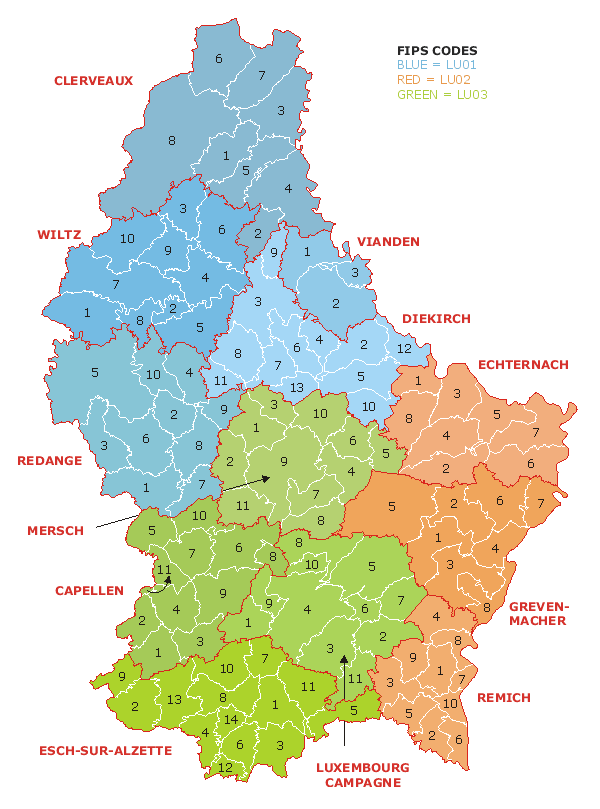
Map of the administrative divisions of Luxembourg. Districts, cantons, and communes are marked and numbered according to FIPS code.
Licencja:
Public domain
Komentarz do licencji:
Released into public domain. See licence below.
Więcej informacji o licencji można znaleźć tutaj. Ostatnia aktualizacja: Sun, 10 May 2020 00:48:30 GMT