Map helgoland 1910

Autor:
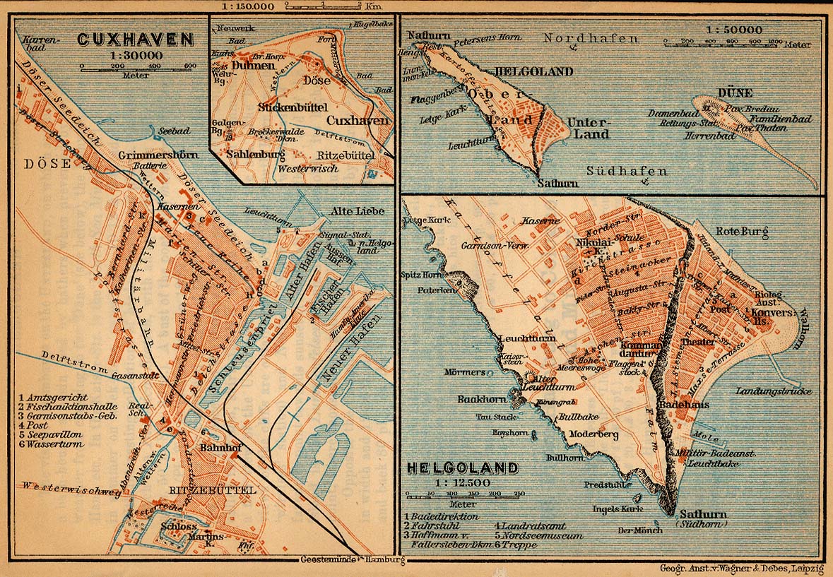
"Northern Germany as far as the Bavarian and Austrian Frontiers; Handbook for Travellers" by Karl Baedeker. Fifteenth Revised Edition. Leipzig, Karl Baedeker; New York, Charles Scribner's Sons 1910.
Credit:
Krótki link:
źródło:
Wymiary:
603 x 769 Pixel (352504 Bytes)
Opis:
Map of Heligoland, Germany, 1910
Licencja:
Public domain
Komentarz do licencji:
"Courtesy of the University of Texas Libraries, The University of Texas at Austin." http://www.lib.utexas.edu/maps/map_sites/hist_sites.html
Więcej informacji o licencji można znaleźć tutaj. Ostatnia aktualizacja: Thu, 23 Dec 2021 16:48:29 GMT