Map of Hven from copper etching of Blaeu Atlas 1663
Autor:
Credit:
(There is no permanent link) Browse to [1], click "View Digital Object", scroll down and click on link "GMG/189/177/mapa", image should appear named "GMG189177mapa.jpeg" in right hand panel.
Krótki link:
źródło:
Wymiary:
6304 x 4939 Pixel (20440767 Bytes)
Opis:
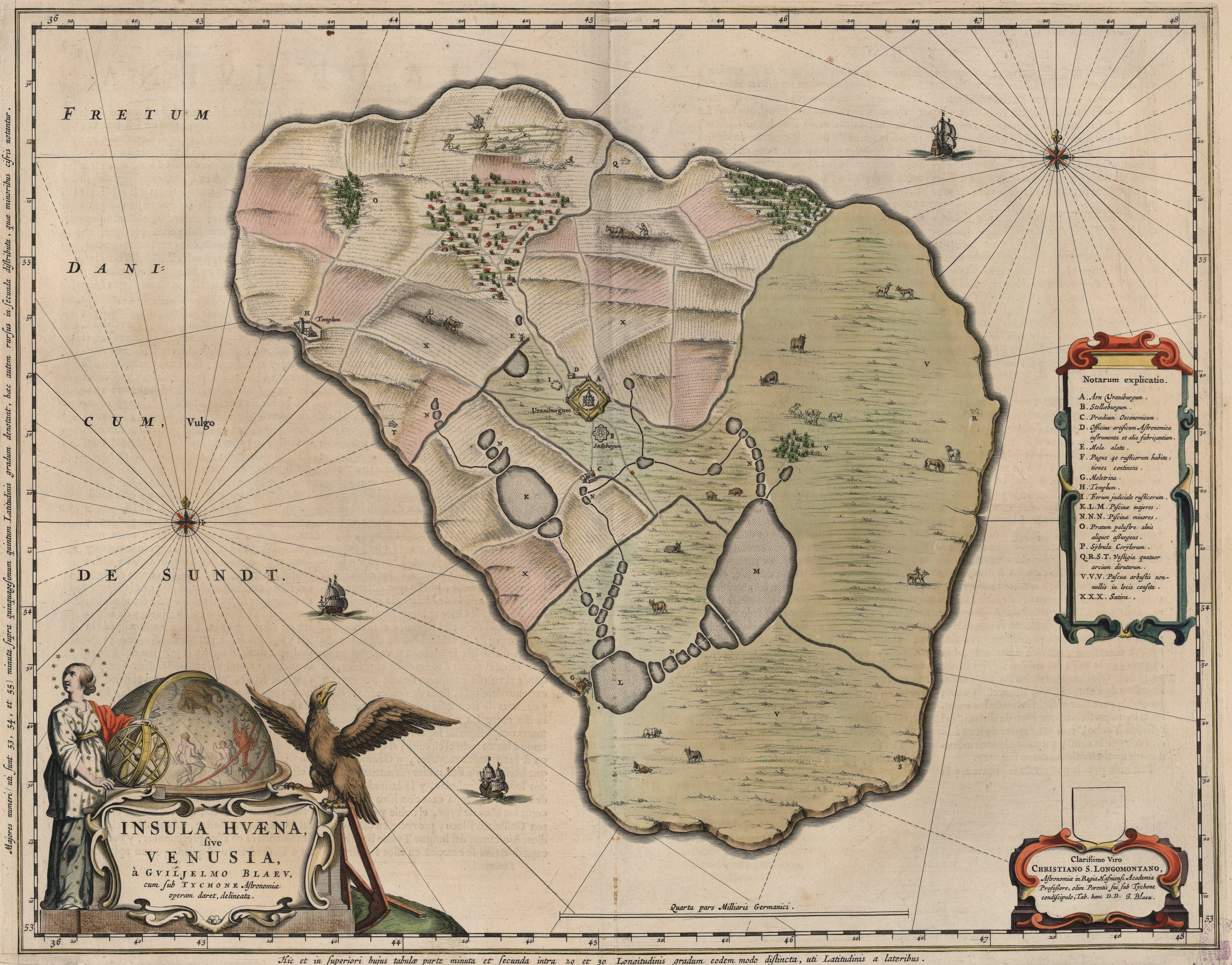
Map of the island of Hven from a copper etching of Willem Janszoon Blaeu's Blaeu Atlas 1663.
Willem made this map based on his experience as a student of Tycho Brahe between 1594 and 1596.
On this map North is up, Denmark to the west and Scania, now part of Sweden, to the east.
It shows the location of Uraniborg just above the centre, and below the linked set of ponds that Tycho had created to both collect water and power his papermill and other small industries on the island.
Name of map : INSULAE HVAENA
Cartographer : Johannes Blaeu
Area displayed : Island of Hven
Map record source: Biblioteca Nacionale Espana (click on "View Digital object" to browse from the first page down to "GMG/189/177/mapa") (1664 is date of atlas on title page at "GMG/189/5/hg-ilustracionr")
vorige upload: Tychobrahe.com
- Originally uploaded on English Wikipedia by en:User:Wikibob.
Licencja:
Public domain
Więcej informacji o licencji można znaleźć tutaj. Ostatnia aktualizacja: Wed, 09 Nov 2022 17:59:51 GMT