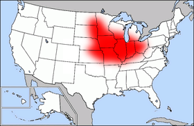
Map of USA highlighting Corn Belt
Autor:
Credit:
Na Commons przeniesiono z en.wikipedia.
Krótki link:
źródło:
Wymiary:
280 x 183 Pixel (41627 Bytes)
Opis:
Public domain map courtesy of The General Libraries, The University of Texas at Austin, modified (by • Benc • 00:30, 13 Aug 2004 (UTC)) to highlight regions.
Licencja:
Public domain
Więcej informacji o licencji można znaleźć tutaj. Ostatnia aktualizacja: Thu, 20 Oct 2022 21:23:00 GMT