Mercury global map 2013-05-14 bright
Autor:
NASA
Credit:
Krótki link:
źródło:
Wymiary:
6132 x 3066 Pixel (14284018 Bytes)
Opis:
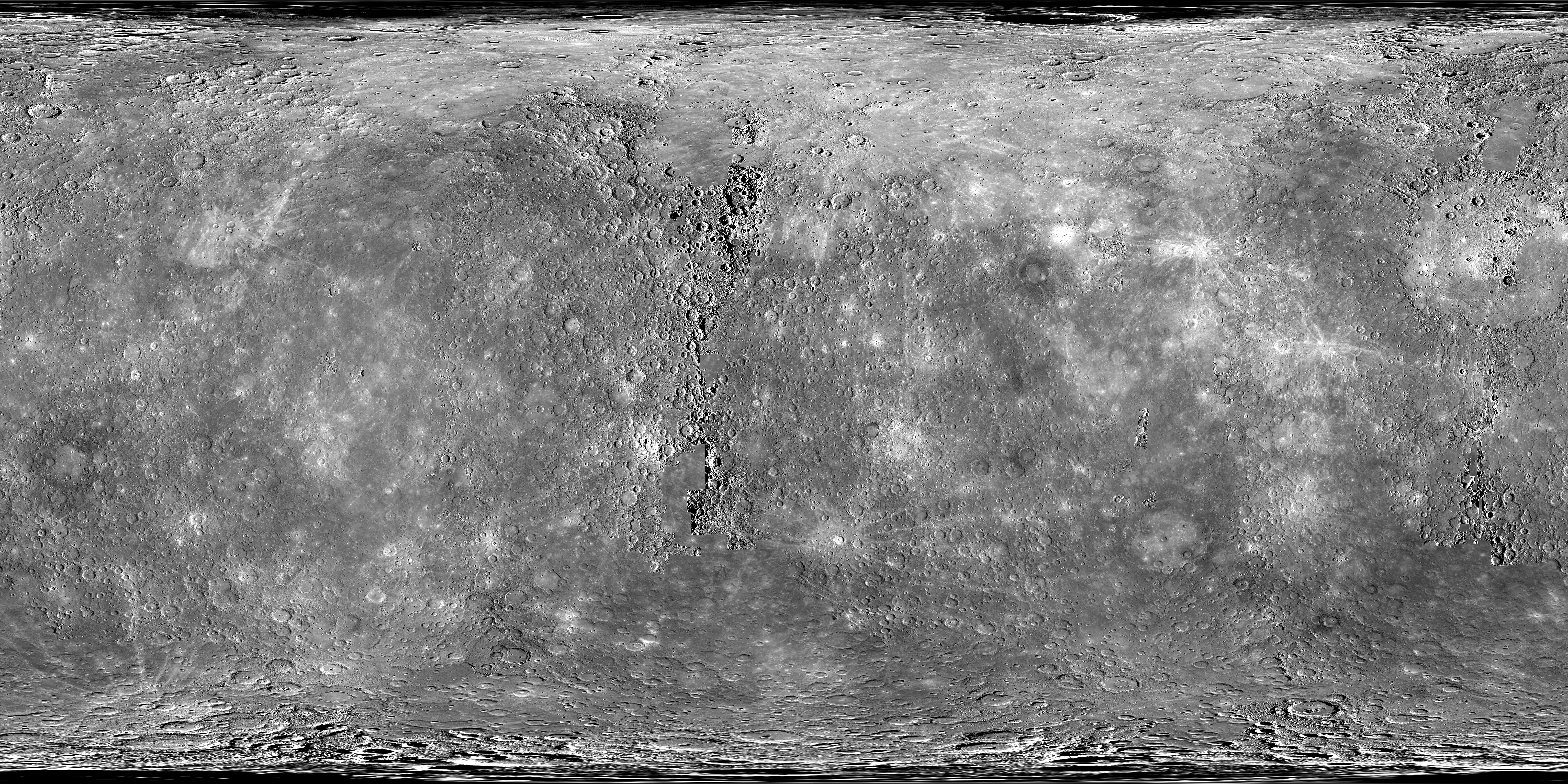
At the very end of 2012, MESSENGER obtained the final image needed to view 100% of Mercury's surface under daylight conditions. The mosaics shown here cover all of Mercury's surface and were produced by using the monochrome mosaic released by NASA's Planetary Data System (PDS) on March 8, 2013, as the base. The full resolution mosaics are available for download on MESSENGER's Global Mosaics webpage.
To fill the area near the north pole, the PDS product was trimmed northward of 83°N and an average mosaic that extended from 82.5°N to 90°N was used, averaging the 0.5° latitude overlap between the PDS mosaic and the average north polar mosaic. To fill the area near the south pole, the PDS product was trimmed southward of 85.5°S and an average mosaic that extended from 85°S to 90°S was used, again averaging the 0.5° latitude overlap. Any remaining gaps in the global mosaic were filled by using images obtained in support of the high-incidence imaging campaign.
This image is a brightness-corrected version of the original (Mercury - complete mono basemap 2500mpp equirectangular.png). Brightness levels were tuned from [0 - 255] to [30 - 180] for increase of contrast.
Licencja:
Public domain
Więcej informacji o licencji można znaleźć tutaj. Ostatnia aktualizacja: Sun, 08 Jan 2023 10:04:40 GMT