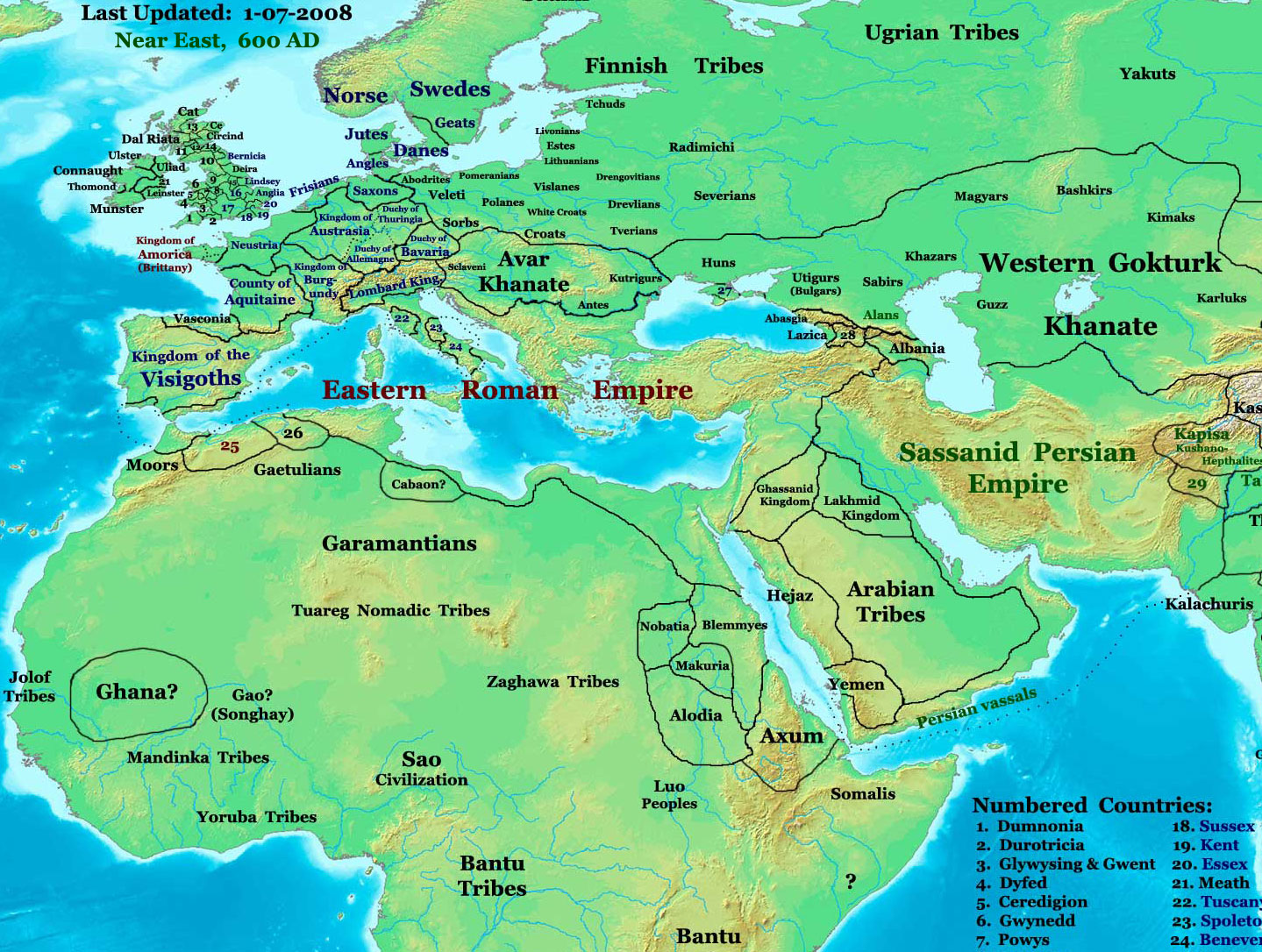
NE 600ad
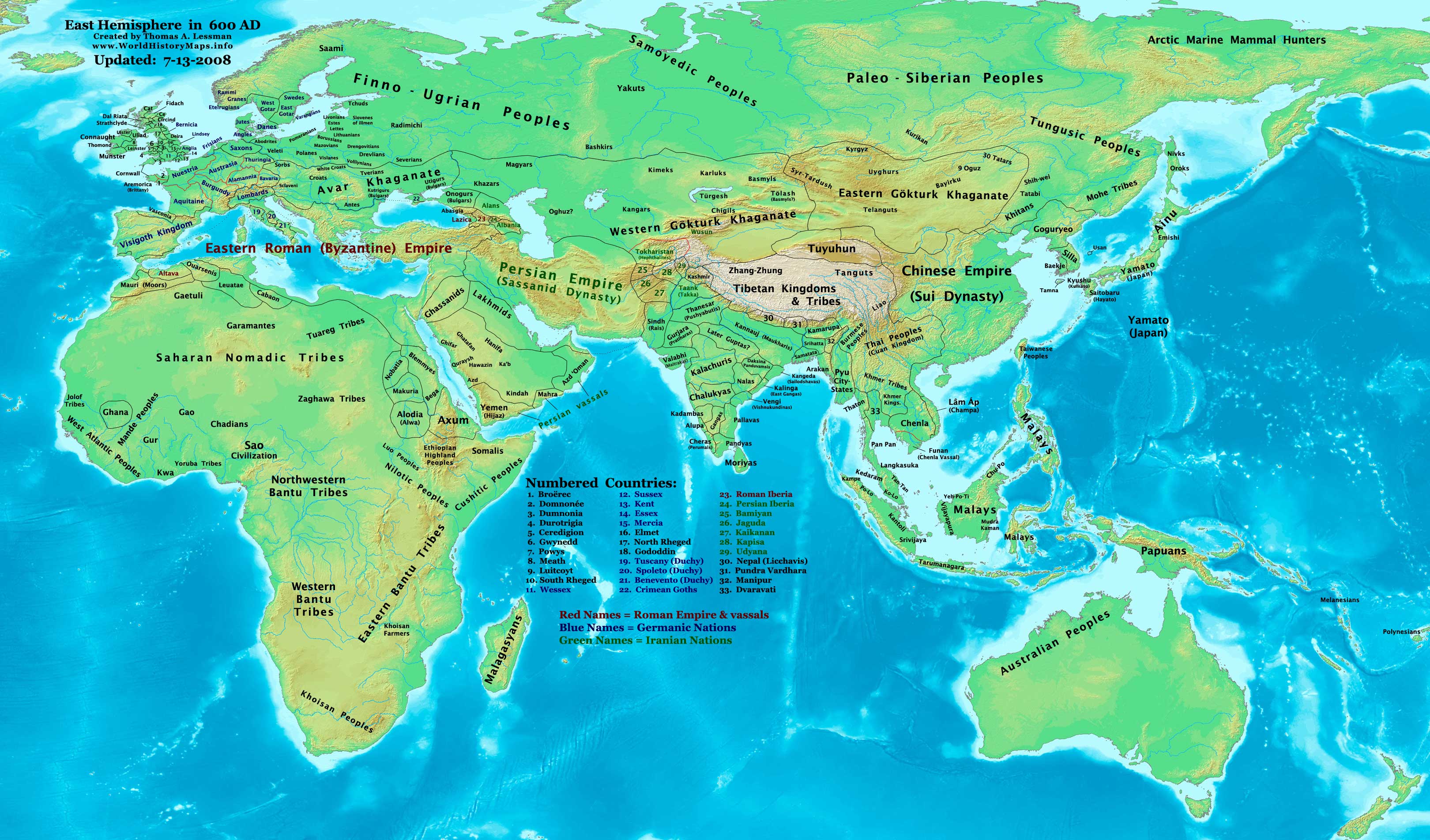
Description: This image is a zoomed-in version of the Eastern Hemisphere in 600 AD.
Author: Thomas A. Lessman (talessman@yis.us), later modified by others.
Source URL: http://www.worldhistorymaps.info/images/East-Hem_600ad.jpg.
Image Summary:Created by Thomas Lessman, based on this map of Eastern Hemisphere in 600 AD. Free for educational use. If you use this image, please credit the author (Thomas Lessman) and include (Source URL: http://www.worldhistorymaps.info/images/East-Hem_600ad.jpg). If you can help improve this map, please contact Thomas Lessman at talessman@yis.us.
Other Historical Maps by Thomas Lessman
| Maps of the eastern hemisphere showing history
Bold dates are available on Wikimedia or Wikipedia. | ||
| Primeval | ||
| Ancient
|
·| 600 BC | 550 BC | 527 BC | 500 BC |
400 BC | ·| 1 AD | 50 AD | 100 AD | 200 AD | 300 AD | | |
| Medieval |
·| 500 AD | 565 AD | 600 AD | 700 AD | | |
| Modern |
·| 1500 AD | · * For historical maps of the whole world, | |
| Ta grafika nie spełnia warunków dla praw autorskich i dlatego jest dostępna jako domena publiczna, gdyż nie zawiera oryginalnego wzornictwa, lecz jedynie kształty używane powszechnie. |
Więcej informacji o licencji można znaleźć tutaj. Ostatnia aktualizacja: Thu, 08 Dec 2022 13:30:45 GMT