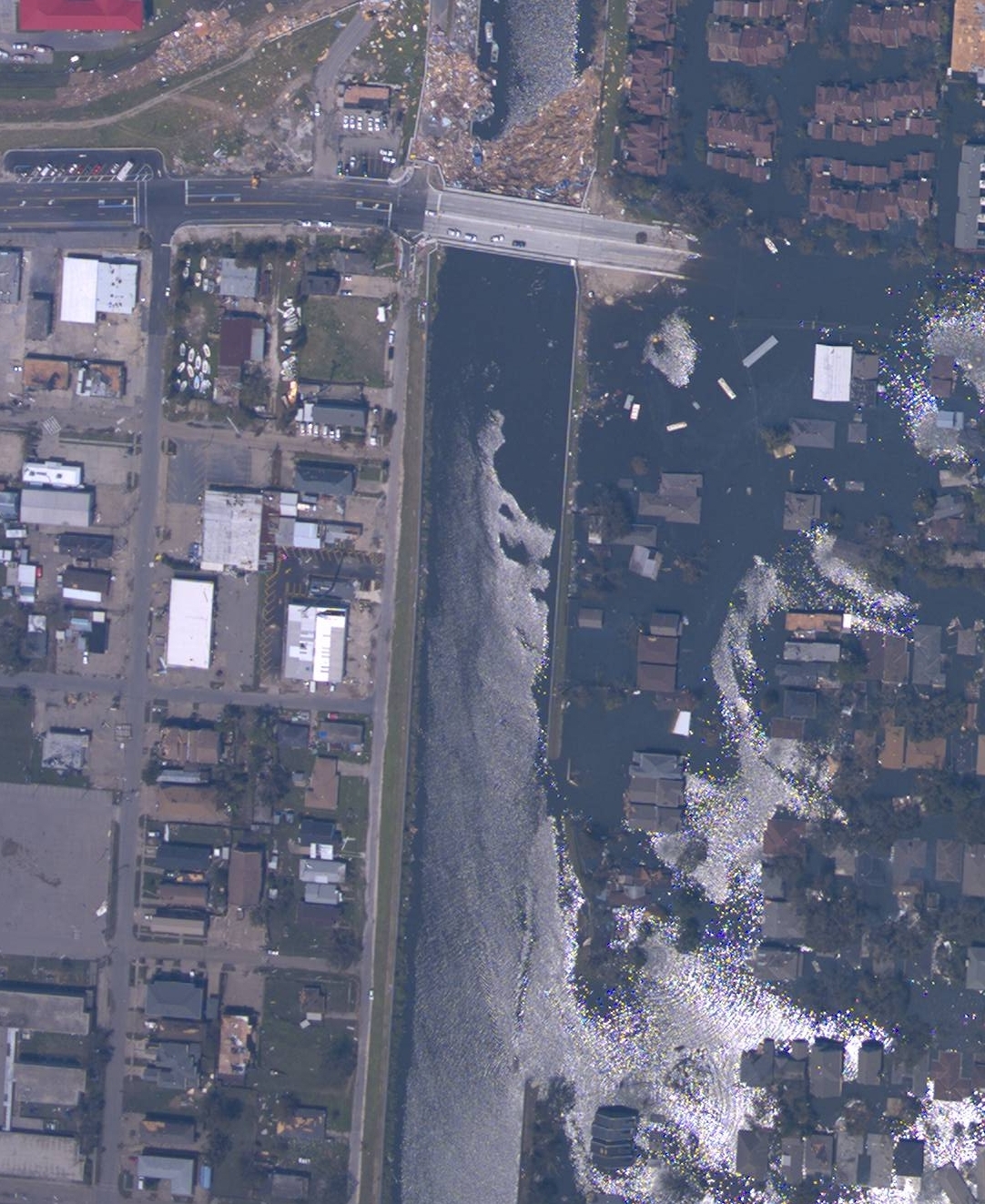
NOAA Katrina NOLA 17th Street breach Aug 31 2005
Autor:
NOAA
Krótki link:
źródło:
Wymiary:
1082 x 1323 Pixel (977324 Bytes)
Opis:
Breach in 17th Street Canal wall in New Orleans, Louisiana. A part of the West End neighborhood of New Orleans is to the right on the east side of the canal, severely flooded; to the left, west of the Canal, is part of Metairie, Louisiana, not flooded. NOAA aerial image taken August 31, 2005. Metal girders and/or plates were later hung along the north side of the Hammond Highway bridge (gray bridge at top, with debris in canal on the north/Lake Pontchartrain side) to block the entrance to the canal. The breach in the canal berm and canal wall (lower right) were closed with helicopter-dropped sandbags and trucks dumping fill southward from Hammond Highway. The breach was closed Monday, September 5, 2005. An opening was then made in the metal wall to allow city drainage through the canal. Repair of the canal levee and floodwall are still ongoing as of April 2006.
Licencja:
Public domain
Więcej informacji o licencji można znaleźć tutaj. Ostatnia aktualizacja: Sun, 23 Oct 2022 18:13:13 GMT