Nederlandsindie
Autor:
Credit:
Na Commons przeniesiono z nl.wikipedia.
Krótki link:
źródło:
Wymiary:
1254 x 450 Pixel (36330 Bytes)
Opis:
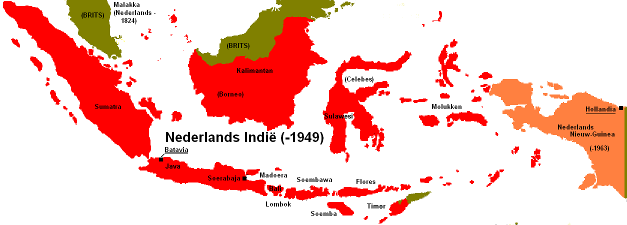
Map of the Dutch East Indies showing the full extent of its boundaries in the early 20th century.
Licencja:
Warunki licencji:
Creative Commons Attribution-Share Alike 3.0
Więcej informacji o licencji można znaleźć tutaj. Ostatnia aktualizacja: Mon, 04 Jul 2022 11:44:57 GMT