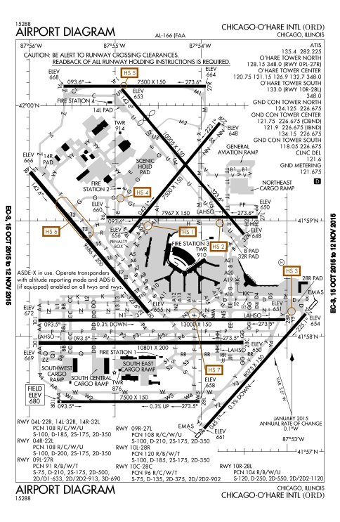
ORD Airport Diagram
Autor:
Produced by the National Aeronautical Charting Office (NACO), a department of the United States en:Federal Aviation Administration.
Credit:
FAA Airport Diagrams; note that these change every 28 days.
Taken from PDF on FAA site and converted to SVG using en:Wikipedia:How to draw SVG circuits using Xcircuit.
Taken from PDF on FAA site and converted to SVG using en:Wikipedia:How to draw SVG circuits using Xcircuit.
Krótki link:
źródło:
Wymiary:
484 x 743 Pixel (3632552 Bytes)
Opis:
FAA Airport Diagram of O'Hare International Airport.
Licencja:
Public domain
Więcej informacji o licencji można znaleźć tutaj. Ostatnia aktualizacja: Mon, 17 Oct 2022 22:41:32 GMT
