Oregon Trail's Sweetwater River 1870
Autor:
Department of the Interior. General Land Office. U.S. Geological and Geographic Survey of the Territories.
Krótki link:
źródło:
Wymiary:
600 x 484 Pixel (69264 Bytes)
Opis:
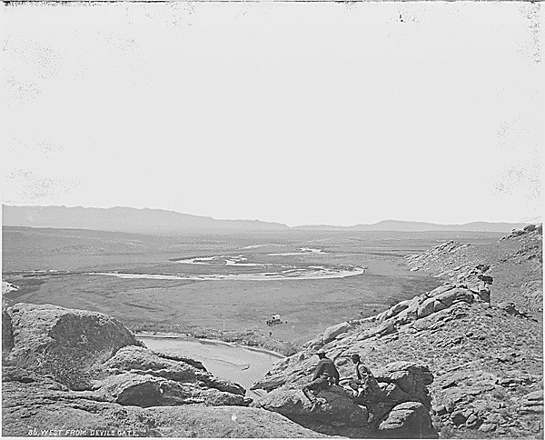
Original description: Looking west from over Devil's Gate showing the plains of the Sweetwater, the Oregon Trail, and the Seminole Mountains in the distance. Gifford and Elliot in the foreground. Ambulance below carrying photo working outfit. Devil's Gate is a narrow cleft in a granite ridge, 400 feet high, the Sweetwater flowing through it. Fremont County, Wyoming., 1870
Licencja:
Public domain
Komentarz do licencji:
Ten szablon nie wskazuje stanu prawnego pliku. Standardowy szablon licencji jest nadal wymagany. Aby dowiedzieć się więcej, zajrzyj na stronę Commons:Licencja.
Więcej informacji o licencji można znaleźć tutaj. Ostatnia aktualizacja: Mon, 22 Aug 2022 16:53:57 GMT