Oslo Areas and barrier projection 2005
Autor:
Credit:
Praca własna. Adaptation of http://www.ochaopt.org/documents/WB_OsloGov&Barrier_July05.pdf on OCHAoPt Map Centre.
Krótki link:
źródło:
Wymiary:
3789 x 7221 Pixel (274755 Bytes)
Opis:
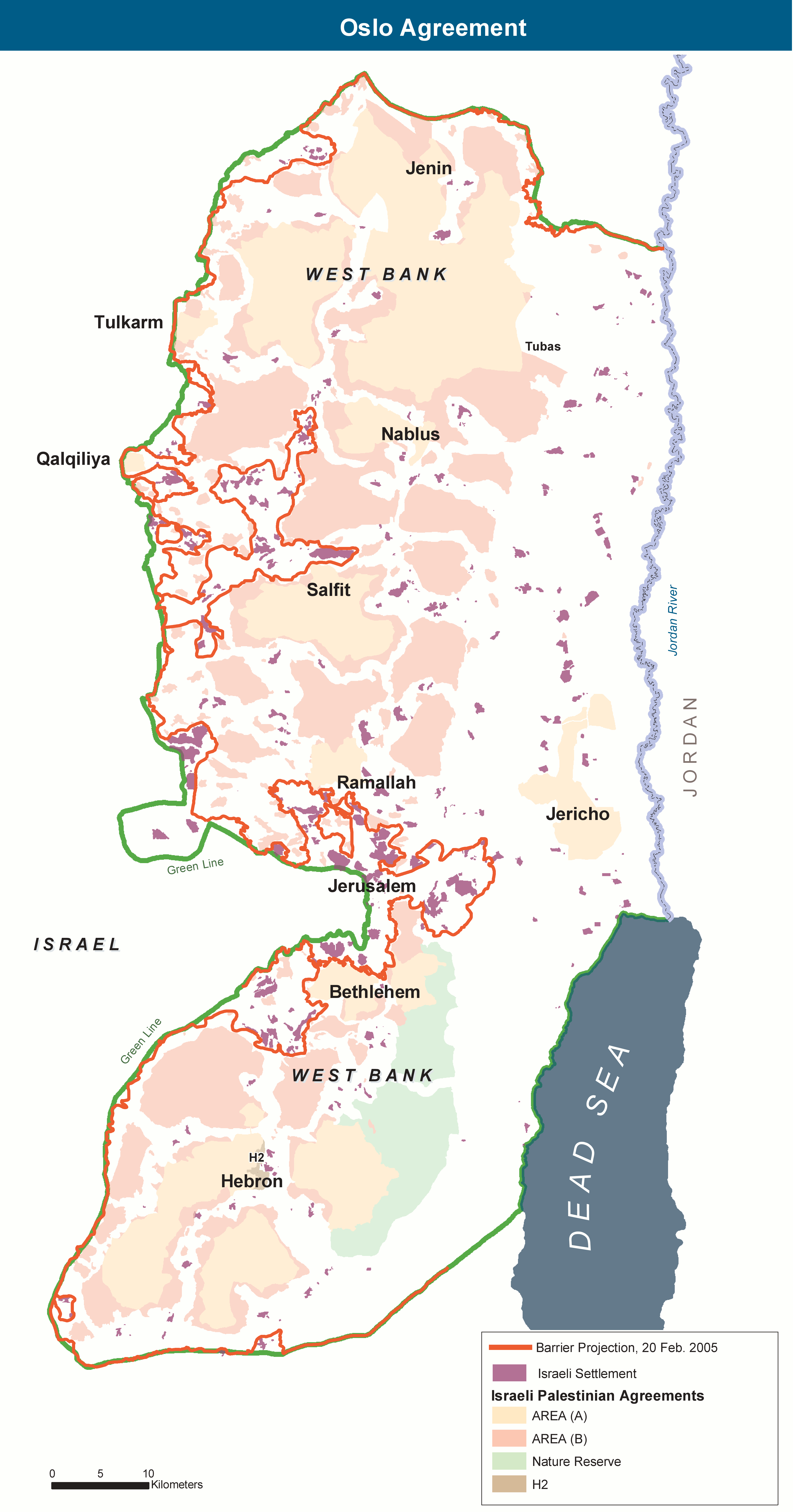
The Areas of the West Bank, created by the Oslo II Accord of 1995, and the Israeli Wall project as of 20 February 2005.
Licencja:
Public domain
Więcej informacji o licencji można znaleźć tutaj. Ostatnia aktualizacja: Fri, 09 Sep 2022 01:54:35 GMT