Paramushir, Atlasov, Shumshu - Landsat 7
Autor:
Data: NASA. Image: Dave Pape
Credit:
Data from USGS GloVis server http://glovis.usgs.gov/. Landsat Orthorectified data generated through NASA's Commercial Remote Sensing Program.
Krótki link:
źródło:
Wymiary:
3600 x 3980 Pixel (3312192 Bytes)
Opis:
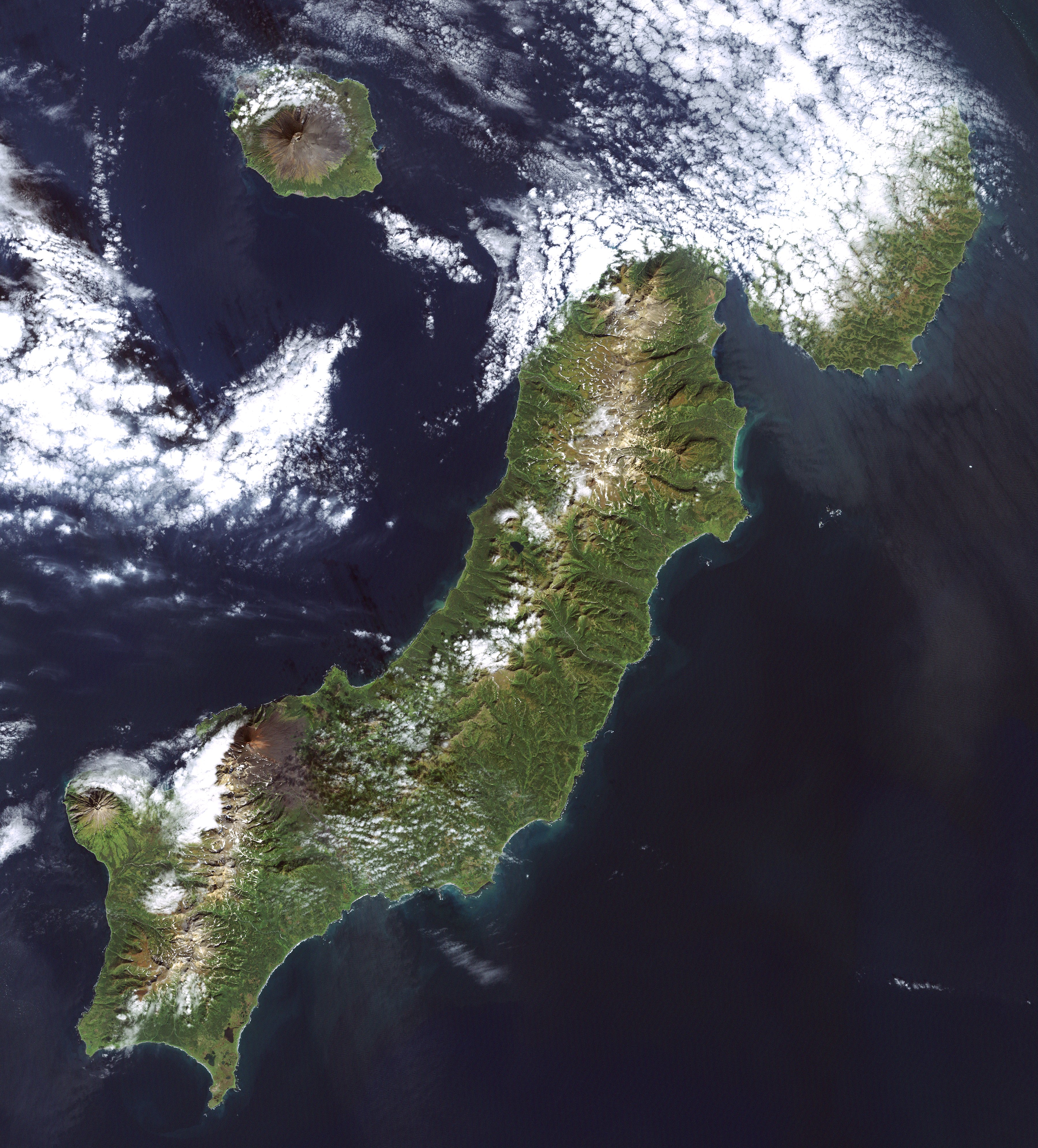
Landsat 7 image of the Kuril Islands of Paramushir, Atlasov, and Shumshu, 28.5 meter resolution. (Shumshu is mostly cloud-covered.) Based on Global Orthorectified Landsat dataset (ETM+); WRS_PATH 100, WRS_ROW 025. Generated using "true-color" combination of bands 3, 2, & 1 as R, G, B respectively. Color curves enhanced in the Gimp.
Licencja:
Public domain
Komentarz do licencji:
Original data PD-NASA; any copyright that exists from my creation of this image is dedicated to the public domain (PD-SELF)
Więcej informacji o licencji można znaleźć tutaj. Ostatnia aktualizacja: Tue, 07 Sep 2021 10:15:20 GMT