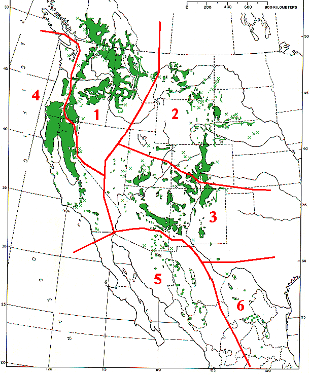
Pinus ponderosa subspecies range map
Autor:
MPF
Credit:
Base map (black outlines & green range map) is from USDA Forest Service Misc,.Publ. 991 (public domain-USGov); red delineation is my work, which I release into public domain
Krótki link:
źródło:
Wymiary:
609 x 746 Pixel (79221 Bytes)
Opis:
Range map of Pinus ponderosa and Pinus arizonica
- Pinus ponderosa subsp. ponderosa - North Plateau Ponderosa Pine
- Pinus ponderosa subsp. scopulorum - Rocky Mts Ponderosa Pine
- Pinus ponderosa subsp. brachyptera - Southwestern Ponderosa Pine
- Pinus ponderosa subsp. benthamiana - Pacific Ponderosa Pine
- Pinus arizonica var. arizonica - Arizona Pine
- Pinus arizonica var. stormiae - Storm's Pine
Licencja:
Public domain
Komentarz do licencji:
|
This image is a work of the Forest Service of the United States Department of Agriculture. As a work of the U.S. federal government, the image is in the public domain.
|
|
Więcej informacji o licencji można znaleźć tutaj. Ostatnia aktualizacja: Thu, 24 Mar 2022 22:16:04 GMT