Polish and Lithuanian Conflict with Prussia. 1377-1435.
Autor:
Autor nie został podany w rozpoznawalny automatycznie sposób. Założono, że to Qp10qp (w oparciu o szablon praw autorskich).
Credit:
Źródło nie zostało podane w rozpoznawalny automatycznie sposób. Założono, że to praca własna (w oparciu o szablon praw autorskich).
Krótki link:
źródło:
Wymiary:
968 x 834 Pixel (186299 Bytes)
Opis:
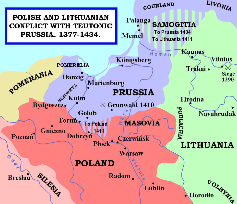
The map shows the areas of conflict between Teutonic Prussia and Poland and Lithuania during the reigns of Jogaila (Władysław II Jagiełło) and Vytautas. The areas on the borders of Prussia and Poland were particularly disputed: towns often changed hands, and Dobrzyń Land (red-and-mauve stripes) was passed back and forward as a result of various deals, treaties, and battles. Samogitia (green-and-mauve stripes) was also strongly disputed between the Teutonic Order and Lithuania, because the Knights wished to link up with the Livonian Lands further north. After the Battle of Grunwald in 1410, a series of treaties established Polish control over Dobrzyń Land and Lithuanian control over Samogitia for good, marking the beginning of the Teutonic State's decline.
Licencja:
Public domain
Więcej informacji o licencji można znaleźć tutaj. Ostatnia aktualizacja: Sat, 27 Aug 2022 04:39:15 GMT