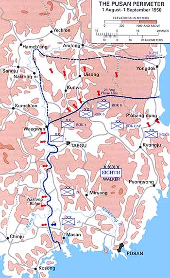
Pusan Perimeter
Autor:
United States Army Center of Military History
Credit:
This map was created by the Center for Military History and used in the brochure "The Korean War: The Outbreak" located at [1].
Krótki link:
źródło:
Wymiary:
350 x 572 Pixel (53434 Bytes)
Opis:
Map of the Pusan Perimeter, August 1950.
Licencja:
Public domain
Więcej informacji o licencji można znaleźć tutaj. Ostatnia aktualizacja: Wed, 04 Jan 2023 04:40:53 GMT