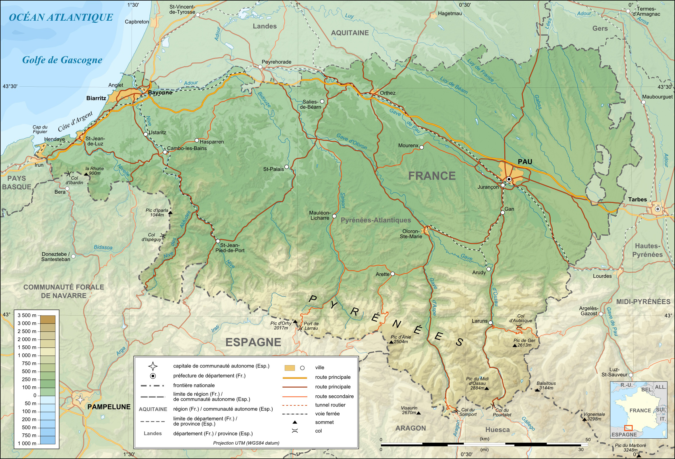
Pyrenees-Atlantiques topographic map-fr
Attribution:
Obraz jest oznaczony jako „Wymagane uznanie autorstwa” (attribution required), ale nie podano żadnych informacji o uznaniu autorstwa. Prawdopodobnie parametr atrybucji został pominięty podczas korzystania z szablonu MediaWiki dla licencji CC-BY. Autorzy mogą znaleźć tutaj przykład prawidłowego korzystania z szablonów.
Credit:
Own work (see complete description on Image:Pyrenees-Atlantiques_topographic_map-fr.svg).
Krótki link:
źródło:
Wymiary:
2350 x 1600 Pixel (1293596 Bytes)
Opis:
Topographic map in French of the department of the Pyrénées-Atlantiques
This is a lighter raster JPG format version of Image:Pyrenees-Atlantiques_topographic_map-fr.svg which should be used in the article pages, the vector graphics version purpose being for modification and / or translation.
Approximate scales :
* Topographic data : 1:400,000 (accuracy : about 100 m) ;
* Bathymetry : 1:4 000 000 (accuracy : about 1,000 m)
Licencja:
Komentarz do licencji:
| Attribution and Share-Alike required |
|---|
| Any use of this map can be made as long as you credit me (Eric Gaba – Wikimedia Commons user: Sting) as the author and distribute the copies and derivative works under the same license(s) that the one(s) stated below. A message with a reply address would also be greatly appreciated. |
Warunki licencji:
Creative Commons Attribution-Share Alike 4.0
Więcej informacji o licencji można znaleźć tutaj. Ostatnia aktualizacja: Sat, 23 Jul 2022 05:39:23 GMT