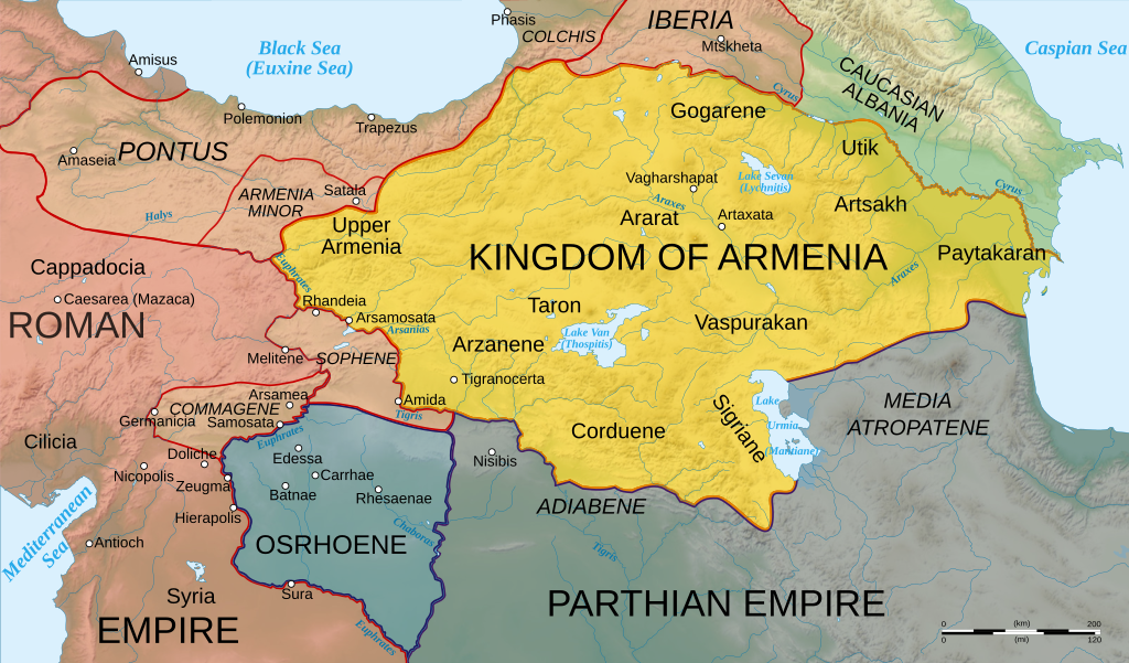
Roman East 50-en
Autor:
Attribution:
Obraz jest oznaczony jako „Wymagane uznanie autorstwa” (attribution required), ale nie podano żadnych informacji o uznaniu autorstwa. Prawdopodobnie parametr atrybucji został pominięty podczas korzystania z szablonu MediaWiki dla licencji CC-BY. Autorzy mogą znaleźć tutaj przykład prawidłowego korzystania z szablonów.
Credit:
Based on Image:Arshakuni Armenia 150-en.svg. Province & client state outlines based on: Atlas of Classical History, Routledge 1985, pp. 160-162; History Map of Europe, Year 1 from Euratlas
Krótki link:
źródło:
Wymiary:
2717 x 1595 Pixel (868553 Bytes)
Opis:
Map of Armenia and the Roman client states in eastern Asia Minor, ca. 50 AD, before the Roman-Parthian War and the annexation of the client kingdoms into the Empire.
Licencja:
Warunki licencji:
Creative Commons Attribution-Share Alike 3.0
Więcej informacji o licencji można znaleźć tutaj. Ostatnia aktualizacja: Fri, 30 Dec 2022 01:50:07 GMT
