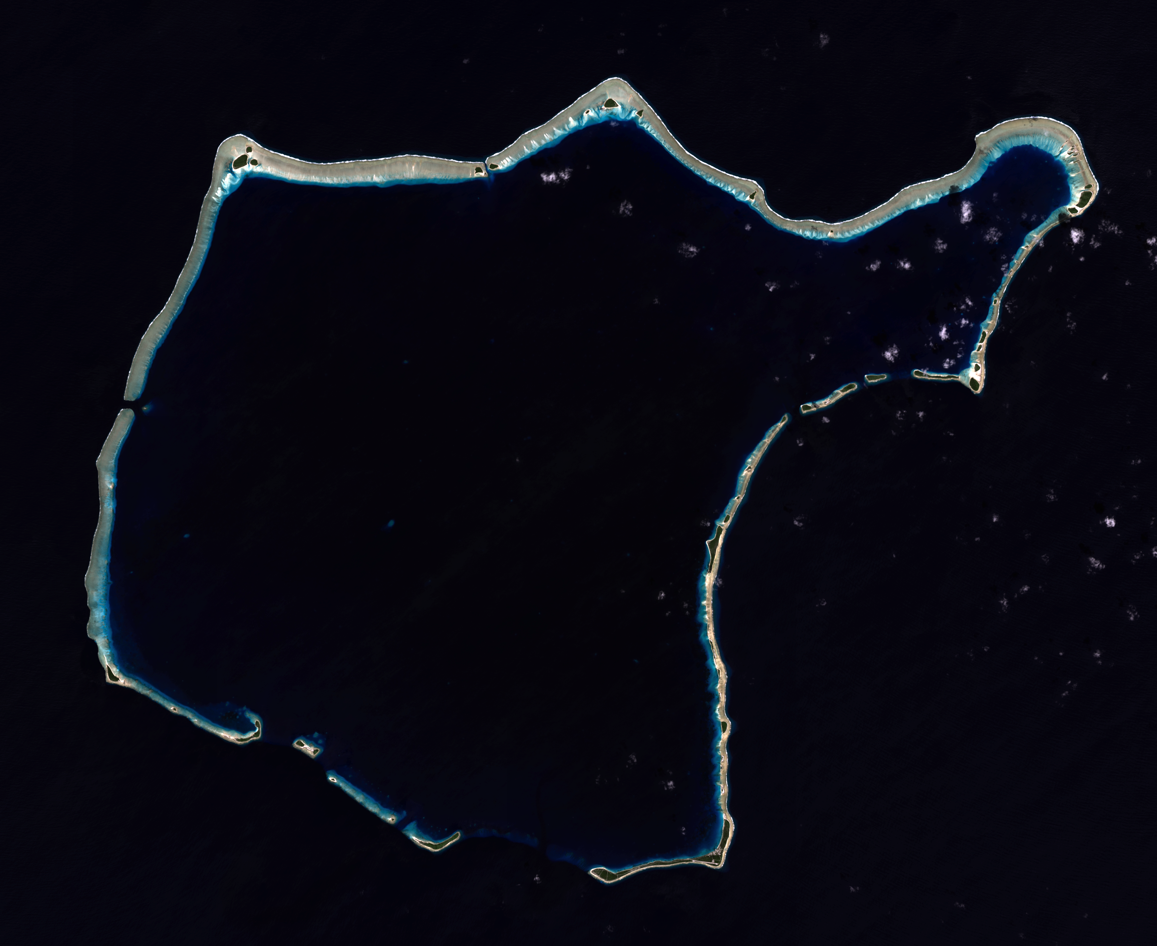
Rongelap Atoll - 2014-12-06 - Landsat 8 - 15m
Autor:
NASA
Credit:
NASA/USGS Landsat satellite image GeoTIFF archive, http://glovis.usgs.gov
Krótki link:
źródło:
Wymiary:
3741 x 3060 Pixel (8263654 Bytes)
Opis:
Composite "true color" multispectral satellite image of Rongelap Atoll.
NASA Landsat 8 OLI bands used were 4 (red), 3 (green), 2 (blue). Pan-sharpened with band 8. Manual color balance. Projection: UTM (zone 58), WGS84. Imagery courtesy NASA/USGS.
(note: atmospheric haze is present and could not be fully removed)
Licencja:
Public domain
Więcej informacji o licencji można znaleźć tutaj. Ostatnia aktualizacja: Tue, 22 Mar 2022 08:21:36 GMT