Ruhr area-map
Autor:
Credit:
"drawn" by myself, Threedots (Daniel Ullrich), with Adobe Photoshop 6.0; used data set: official GeoData (former URL: www.ruhrgebiet.de/daten/geodatenserver.shtml) and several other maps
Krótki link:
źródło:
Wymiary:
1000 x 593 Pixel (87888 Bytes)
Opis:
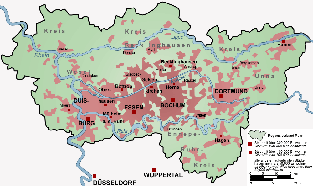
Map of the Ruhr area, Germany – The map shows the Ruhr Area (Regionalverband Ruhr) with all cities with more than 50,000 inhabitants.
Licencja:
Warunki licencji:
Creative Commons Attribution-Share Alike 3.0
Więcej informacji o licencji można znaleźć tutaj. Ostatnia aktualizacja: Thu, 08 Sep 2022 01:28:43 GMT