Saltonseadrainagemap
Autor:
Attribution:
Obraz jest oznaczony jako „Wymagane uznanie autorstwa” (attribution required), ale nie podano żadnych informacji o uznaniu autorstwa. Prawdopodobnie parametr atrybucji został pominięty podczas korzystania z szablonu MediaWiki dla licencji CC-BY. Autorzy mogą znaleźć tutaj przykład prawidłowego korzystania z szablonów.
Credit:
Background and river course data from http://www2.demis.nl/mapserver/mapper.asp and some topography from http://seamless.usgs.gov/website/seamless/viewer.htm
Krótki link:
źródło:
Wymiary:
782 x 735 Pixel (284640 Bytes)
Opis:
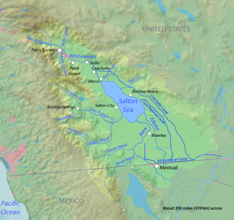
Map of the Salton Sea drainage area in the Salton Sink endorheic basin.
- In the southeastern Coachella Valley and northwestern Imperial Valley — in Imperial and Riverside Counties.
- With the New River, Whitewater River, Alamo River and other tributaries; as well as All-American Canal, and Coachella and East Highline Canals indicated.
Licencja:
Warunki licencji:
Creative Commons Attribution-Share Alike 4.0
Więcej informacji o licencji można znaleźć tutaj. Ostatnia aktualizacja: Thu, 01 Dec 2022 20:15:32 GMT