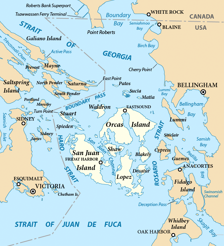
San Juan Islands map
Autor:
Attribution:
Obraz jest oznaczony jako „Wymagane uznanie autorstwa” (attribution required), ale nie podano żadnych informacji o uznaniu autorstwa. Prawdopodobnie parametr atrybucji został pominięty podczas korzystania z szablonu MediaWiki dla licencji CC-BY. Autorzy mogą znaleźć tutaj przykład prawidłowego korzystania z szablonów.
Credit:
Praca własna
Krótki link:
źródło:
Wymiary:
784 x 861 Pixel (516109 Bytes)
Opis:
Map of the San Juan Islands (highlighted) and surrounding region. Created with ArcExplorer and Adobe Illustrator. Based on on GeoBase and The National Map data. Map projection: Washington State Plane North (State Plane Coordinate System).
Licencja:
Warunki licencji:
Creative Commons Attribution-Share Alike 3.0
Więcej informacji o licencji można znaleźć tutaj. Ostatnia aktualizacja: Wed, 20 Jul 2022 02:17:39 GMT