Satellite image of Japan in May 2003
Autor:
Jeff Schmaltz, MODIS Rapid Response Team, NASA/GSFC
Credit:
Cropped from http://visibleearth.nasa.gov/view_rec.php?id=5319
Krótki link:
źródło:
Wymiary:
5800 x 7200 Pixel (3865182 Bytes)
Opis:
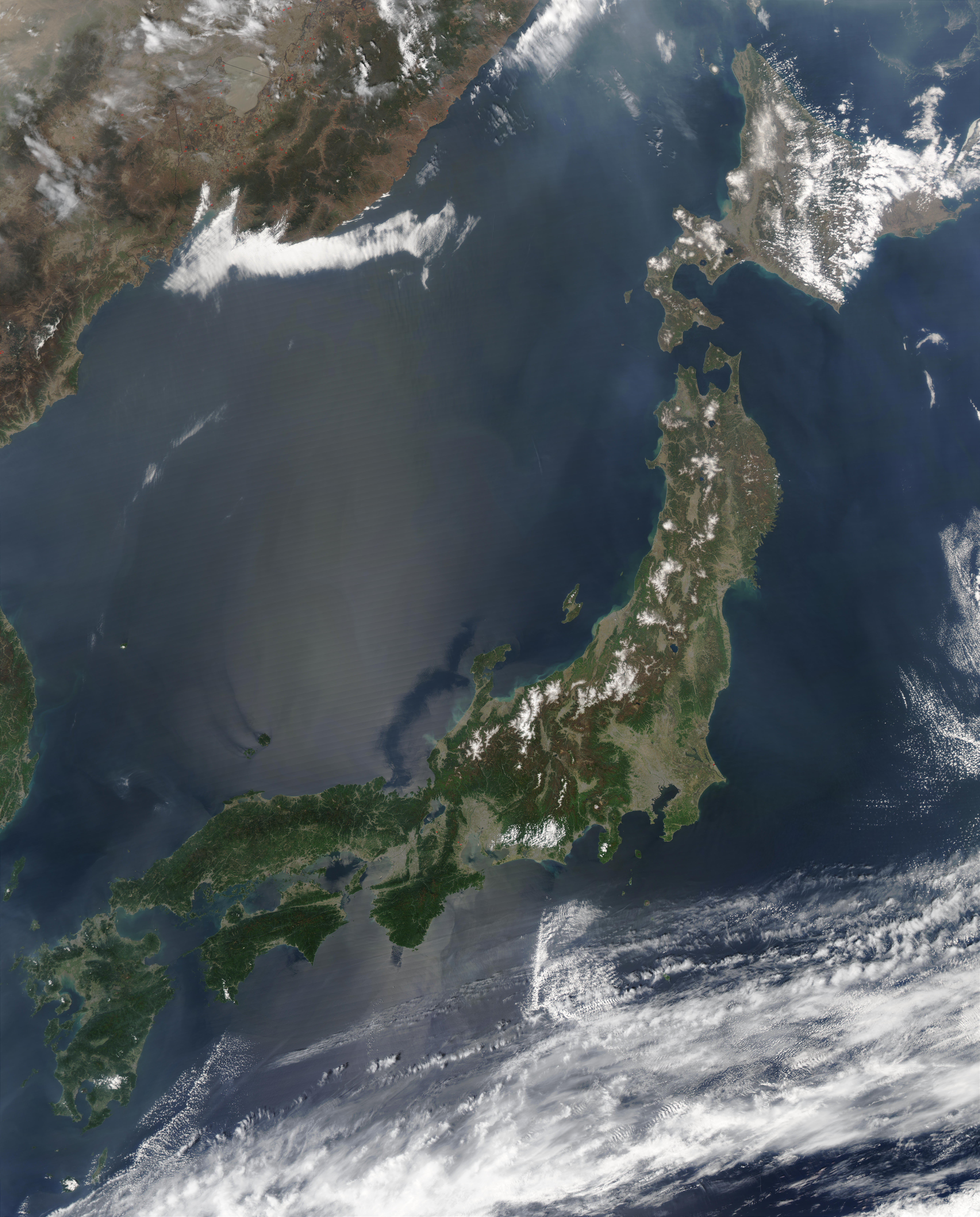
Satellite image of Japan in May 2003.
- The islands of Japan are shown clearly off the coast of North and South Korea, China, and Russia in this true-color image. Running down through the islands are a string of mountains that make up part of the Pacific “Ring of Fire.†The Ring of Fire is a zone of frequent earthquakes and volcanic eruptions that stretches in a series of arcs from New Zealand, through Indonesia, up through the Philippines, Japan, the Kuril Islands and Kamchatka Peninsula (Russia), across the Pacific Ocean via the Aleutian Islands, and down the coast of the Americas. Seventy-five percent of the world’s volcanoes are in this ring, making it the most volcanically-active region on the planet. Also shown in this image are a number of fires, which are marked with red dots. A few fires were detected in Japan, China, and North Korea, but the majority were detected in Russia’s Primorskiy-Kray region. This true-color Aqua MODIS image was acquired on May 1, 2003.
Licencja:
Public domain
Więcej informacji o licencji można znaleźć tutaj. Ostatnia aktualizacja: Wed, 19 Oct 2022 17:13:23 GMT