Sea Otter Enhydra lutris distribution map 2
and the IUCN Red List spatial data, CC BY-SA 4.0
Autor:
Darekk2 using the IUCN Red List spatial data
Credit:
Ta mapa została stworzona za pomocą GMT.
Krótki link:
źródło:
Wymiary:
800 x 508 Pixel (56803 Bytes)
Opis:
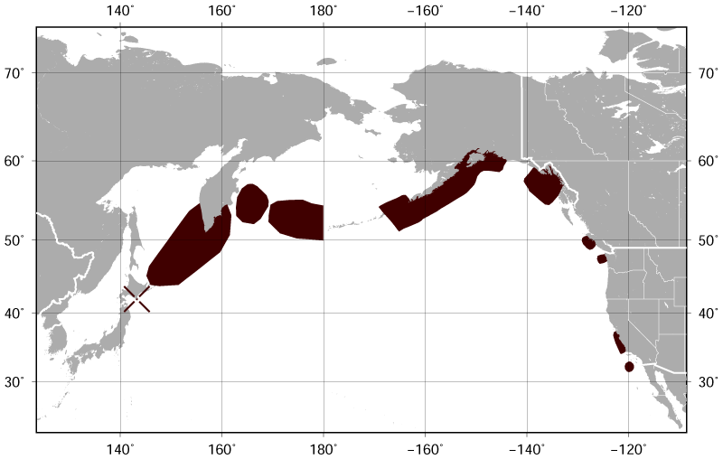
Geographical distribution of the Sea Otter Enhydra lutris.
The map was created using the Generic Mapping Tools, GMT, version 5.1.2.
The map was created using the Generic Mapping Tools, GMT, version 5.1.2.
Licencja:
Warunki licencji:
Creative Commons Attribution-Share Alike 4.0
Więcej informacji o licencji można znaleźć tutaj. Ostatnia aktualizacja: Tue, 01 Nov 2022 09:18:05 GMT