Senkaku Diaoyu Tiaoyu Islands
Autor:
Attribution:
Obraz jest oznaczony jako „Wymagane uznanie autorstwa” (attribution required), ale nie podano żadnych informacji o uznaniu autorstwa. Prawdopodobnie parametr atrybucji został pominięty podczas korzystania z szablonu MediaWiki dla licencji CC-BY. Autorzy mogą znaleźć tutaj przykład prawidłowego korzystania z szablonów.
Krótki link:
źródło:
Wymiary:
900 x 900 Pixel (290587 Bytes)
Opis:
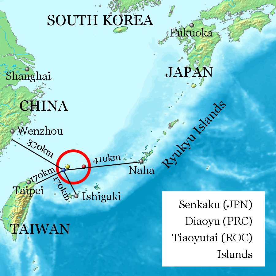
Uotsuri-shima / Diaoyu Dao (Blue, west end and nearly south end, 25°44′33″N 123°28′17″E at Mount Narahara), Kuba-shima / Huangwei Yu (Yellow, north end, 25°55′24″N 123°40′51″E at Mount Chitose), Taishō-tō / Chiwei Yu (Red, east end, 25°55′21″N 124°33′36″E at the peek) referenced on Geospatial Information Authority of Japan and distances referenced on Ministry of Foreign Affairs of Japan. Every distances of the map show coast to coast, but distances of the coast of Okinawa Island and Naha City, and the coast of Ishigaki-Island and Ishigaki City are quite near on the map.
Licencja:
Warunki licencji:
Creative Commons Attribution-Share Alike 3.0
Więcej informacji o licencji można znaleźć tutaj. Ostatnia aktualizacja: Thu, 29 Dec 2022 14:18:28 GMT