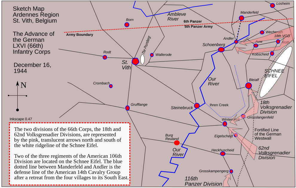
St Vith Map Ardennes
Autor:
Attribution:
Obraz jest oznaczony jako „Wymagane uznanie autorstwa” (attribution required), ale nie podano żadnych informacji o uznaniu autorstwa. Prawdopodobnie parametr atrybucji został pominięty podczas korzystania z szablonu MediaWiki dla licencji CC-BY. Autorzy mogą znaleźć tutaj przykład prawidłowego korzystania z szablonów.
Credit:
Praca własna
Krótki link:
źródło:
Wymiary:
990 x 630 Pixel (70126 Bytes)
Opis:
This is a map of the Ardennes, Belgium, showing the advance of the German LXVI Corps on St. Vith, December 16, 1944. This is a sketch map, not to scale, but the furthest German advance covers about five miles. This map was drawn on Inkscape version 0.47.
Licencja:
Warunki licencji:
Creative Commons Attribution-Share Alike 3.0
Więcej informacji o licencji można znaleźć tutaj. Ostatnia aktualizacja: Wed, 17 Aug 2022 19:34:21 GMT
