Tasmania.A2005320.2355.250m

Autor:
Jeff Schmaltz, MODIS Rapid Response Team, NASA/GSFC
Credit:
Krótki link:
źródło:
Wymiary:
1600 x 2000 Pixel (462005 Bytes)
Opis:
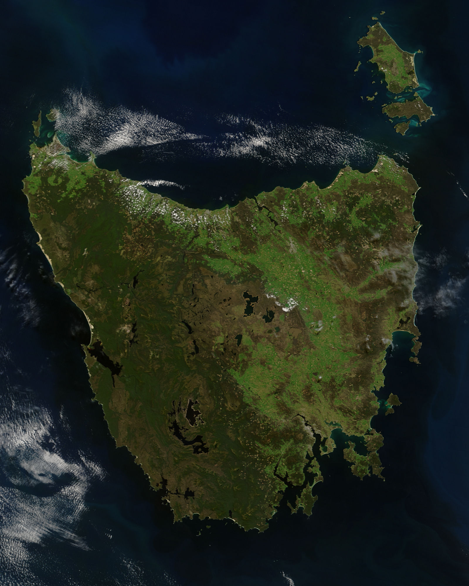
A true-colour satellite view of Tasmania, including Flinder's Island, taken in the spring of 2005.
Description from NASA's Visible Earth website: http://visibleearth.nasa.gov/view.php?id=74906
Tasmania was emerald green with the flush of late spring when the Moderate Resolution Imaging Spectroradiometer (MODIS) on NASA’s Terra satellite captured this image on November 16, 2005. The western half of the island is covered with dense forest, which is darker green than grasslands in the east. Sitting below 40 degrees South, the island is the only part of Australia able to support a temperate rainforest. Above the northeast corner of Tasmania are Flinders Island (top), Cape Barren Island (center), and Clarke Island (closest to Tasmania). Tasmania is thought to have been a part of mainland Australia until the end of the last ice age 10,000 years ago when sea levels rose and made Tasmania into an island.
Licencja:
Public domain
Więcej informacji o licencji można znaleźć tutaj. Ostatnia aktualizacja: Wed, 19 Oct 2022 17:14:13 GMT