Temburong mukims
Autor:
Credit:
Na Commons przeniósł z en.wikipedia użytkownik Xfigpower.
Krótki link:
źródło:
Wymiary:
696 x 565 Pixel (58417 Bytes)
Opis:
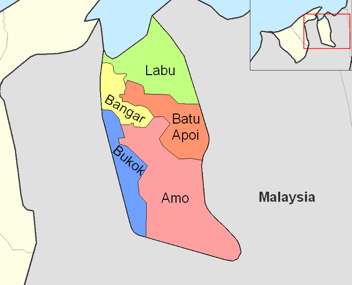
Map of the mukims (subdivisions) of the Temburong District of Brunei, in the northwest of the island of Borneo.
Created by Rarelibra 21:37, 11 September 2006 (UTC) for public domain use, using MapInfo Professional v8.5 and various mapping resources.
Licencja:
Public domain
Więcej informacji o licencji można znaleźć tutaj. Ostatnia aktualizacja: Fri, 25 Mar 2022 18:09:15 GMT