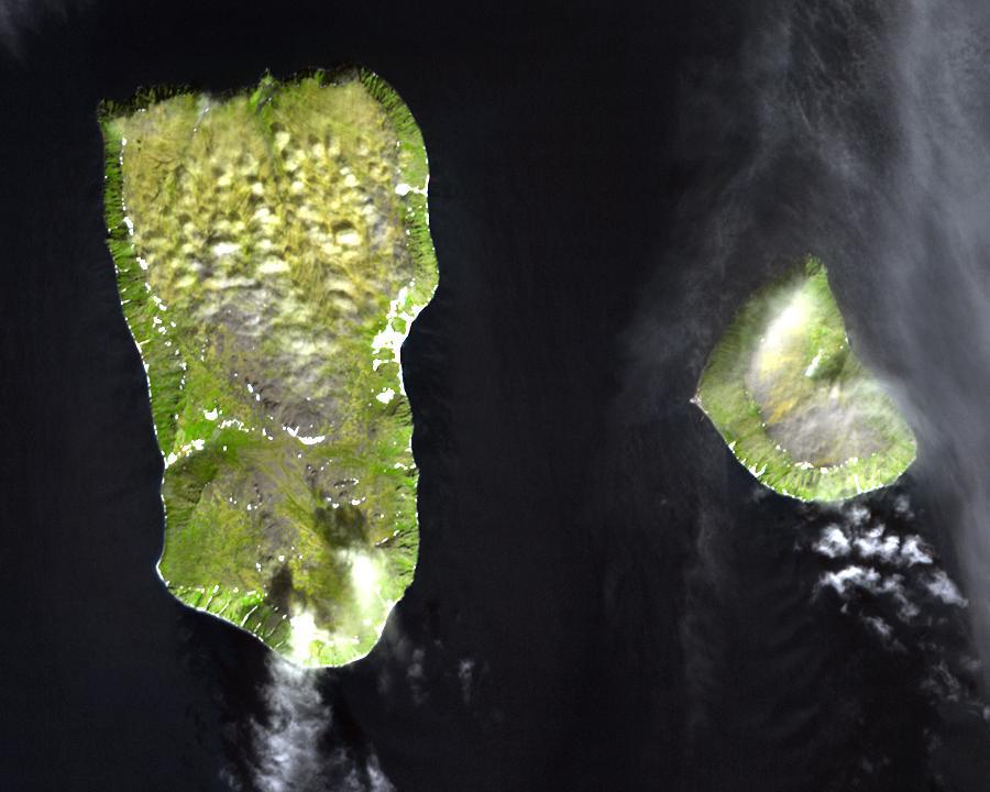
The Diomede Islands in the BeringSea (picture from space)
Autor:
Nieznany
Credit:
- Image: diomede.jpg
- Text info: Diomede Islands, Bering Strait
Krótki link:
źródło:
.jpg?uselang=pl)
Wymiary:
900 x 720 Pixel (67387 Bytes)
Opis:
Diomede Islands in the middle of the Bering Strait:. The islands are separated by the border between Russia and the USA and by the International Date Line.
- Western: Russian island of Big Diomede, Imaqliq, Nunarbuk or Ratmanov Island
- Eastern: U.S. island of Little Diomede, in its native language Inaliq or Krusenstern Island (this is the island w:en:Sarah Palin was talking about when she said, "They're our next-door neighbors, and you can actually see Russia from land here in Alaska, from an island in Alaska.")
Licencja:
Public domain
Komentarz do licencji:
This file is in the public domain because it was created by NASA. NASA copyright policy states that "NASA material is not protected by copyright unless noted". (NASA copyright policy page or JPL Image Use Policy). This image does not contain a NASA logo.
Więcej informacji o licencji można znaleźć tutaj. Ostatnia aktualizacja: Sat, 31 Dec 2022 09:05:10 GMT