USACE Navarro Mills Lake and Dam
Autor:
U.S. Army Corps of Engineers, photographer not specified or unknown
Credit:
U.S. Army Corps of Engineers Digital Visual Library
Image page
Image description page
Digital Visual Library home page
Image page
Image description page
Digital Visual Library home page
Krótki link:
źródło:
Wymiary:
1500 x 1000 Pixel (438293 Bytes)
Opis:
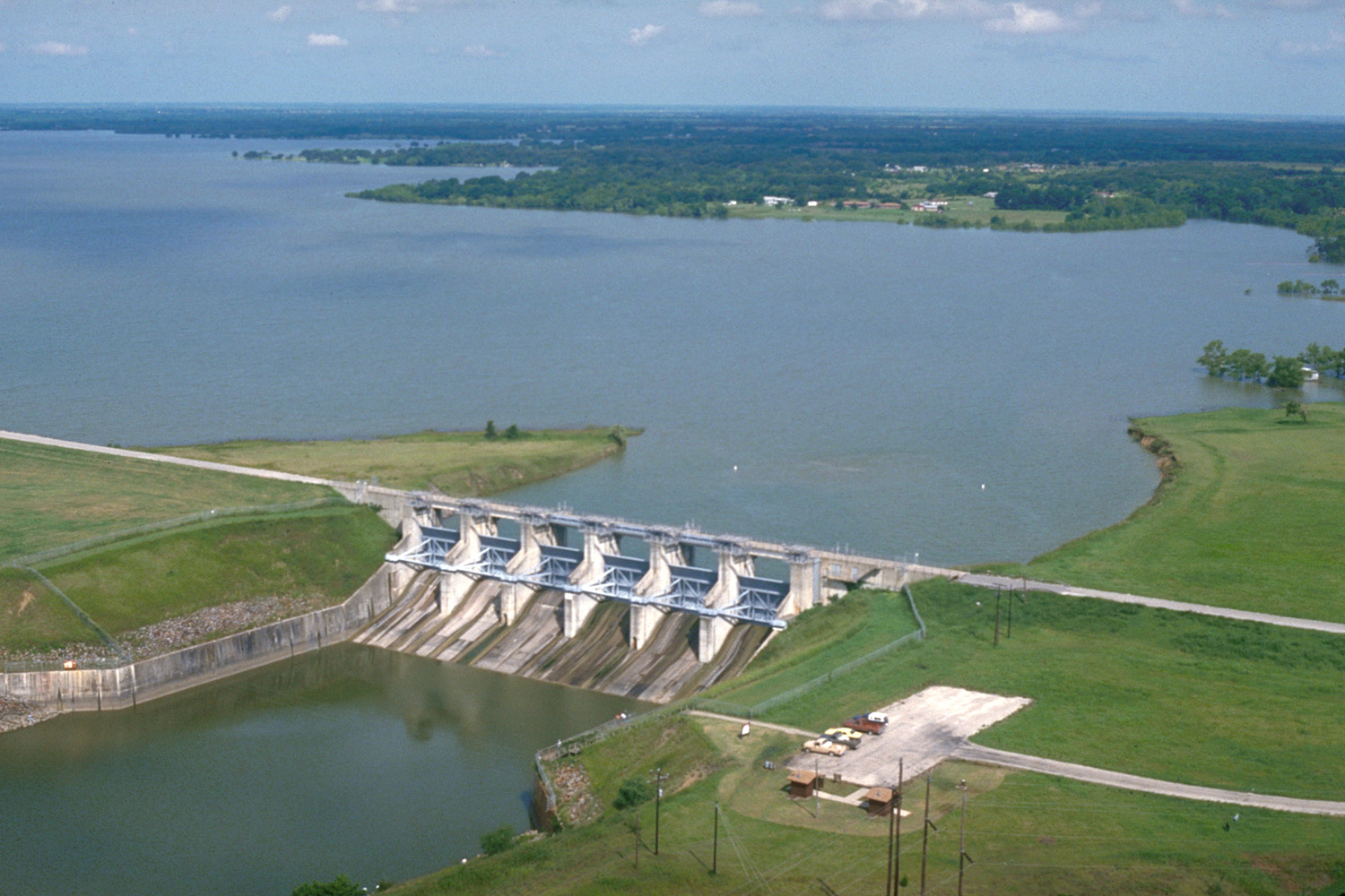
Aerial view of Navarro Mills Lake and Dam on Richland Creek in Navarro County, Texas, USA. The U.S. Army Corps of Engineers constructed this dam in 1963 for flood control and water supply for Navarro County. This concrete and earth-fill dam is about three-quarters of a mile (1 km) long, but this photograph shows only the central water-control structure of the dam. View is to the northwest.
Licencja:
Public domain
Komentarz do licencji:
This image or file is a work of a U.S. Army Corps of Engineers soldier or employee, taken or made as part of that person's official duties. As a work of the U.S. federal government, the image is in the public domain.
Więcej informacji o licencji można znaleźć tutaj. Ostatnia aktualizacja: Wed, 20 Jul 2022 16:19:10 GMT