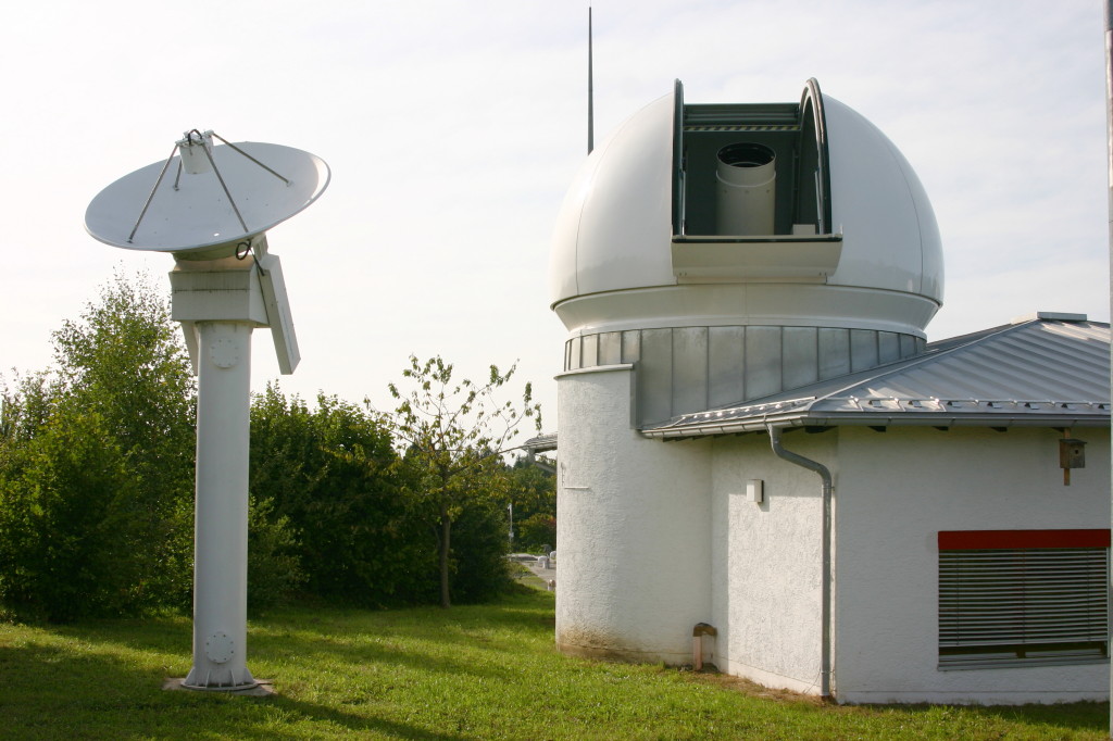
Wettzell Laser Ranging System
Autor:
H. Raab (User:Vesta)
Attribution:
Obraz jest oznaczony jako „Wymagane uznanie autorstwa” (attribution required), ale nie podano żadnych informacji o uznaniu autorstwa. Prawdopodobnie parametr atrybucji został pominięty podczas korzystania z szablonu MediaWiki dla licencji CC-BY. Autorzy mogą znaleźć tutaj przykład prawidłowego korzystania z szablonów.
Credit:
Praca własna
Krótki link:
źródło:
Wymiary:
1024 x 682 Pixel (169041 Bytes)
Opis:
Wettzell Laser Ranging System (WLRS), the satellite and lunar laser ranging system of the geodetic observatory in Wettzell, Bavaria. The 75cm telescope in the dome is both used to send the laser pulses and to observe the reflected signal. The small radar dish besides the dome is used to monitor air traffic: The laser is automatically switched off when a aircraft approaches the target position of the laser.
Licencja:
Warunki licencji:
Creative Commons Attribution-Share Alike 3.0
Więcej informacji o licencji można znaleźć tutaj. Ostatnia aktualizacja: Sun, 02 Oct 2022 10:15:42 GMT