Lundy (wyspa)
| ||
 | ||
| Kontynent | Europa | |
| Państwo | ||
| Akwen | Ocean Atlantycki | |
| Powierzchnia | 4,45 km² | |
 | ||
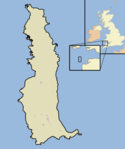
Lundy – mała wyspa u wybrzeży Wielkiej Brytanii o powierzchni 4,45 km², największa w Kanale Bristolskim. Położona jest około 19 km od wybrzeży angielskiego hrabstwa Devon. Na wyspie znajdują się dwie latarnie morskie Lundy North oraz Lundy South.
Linki zewnętrzne
Media użyte na tej stronie
Autor: Nick Stenning from UK, Licencja: CC BY-SA 2.0
I'd rather have stayed there for a week.
A map of the Island of Lundy, in the Bristol Channel, part of the United Kingdom
Autor: Alexrk2, Licencja: CC BY-SA 3.0
Location map of the United Kingdom
Autor: Nilfanion, Licencja: CC BY-SA 3.0
Relief map of England, UK.
Equirectangular map projection on WGS 84 datum, with N/S stretched 170%
Geographic limits:
- West: 6.75W
- East: 2.0E
- North: 56.0N
- South: 49.75N


