Timóteo
| |||||
 | |||||
| Państwo | |||||
| Stan | |||||
| Data założenia | 1964 | ||||
| Powierzchnia | 145,159 km² | ||||
| Populacja (2010) • liczba ludności • gęstość | 81 119[1] 558,83 os./km² | ||||
| Nr kierunkowy | 31 | ||||
| Kod pocztowy | 35180-000 a 35184-999<ref name="Correios_BuscaCEP"/> | ||||
| Strona internetowa | |||||
Timóteo – miasto i gmina w Brazylii, w stanie Minas Gerais. Znajduje się w mezoregionie Vale do Rio Doce i mikroregionie Ipatinga.
Przypisy
Media użyte na tej stronie
Coat of arms of Timóteo, Minas Gerais, Brazil.
Autor: HVL, Licencja: CC BY 3.0
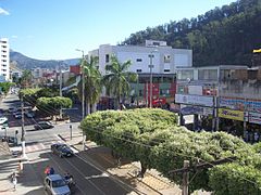
View of the 31 de Outubro (31 October) Avenue seen from of the Bretas supermarket, in Timóteo, Minas Gerais, Brazil.
Flag of Timóteo, Minas Gerais, Brazil.
Autor:
- MinasGerais_MesoMicroMunicip.svg: Raphael Lorenzeto de Abreu
- derivative work: Milenioscuro (talk)
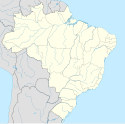
Location map of Minas Gerais state.
Equirectangular projection, N/S stretching 106 %. Geographic limits of the map:
- N: 13.93° S
- S: 23.67° S
- W: 51.80° W
- E: 39.80° W


