US landings
Autor:
General MacArthur's General Staff
Credit:
MacArthur, Douglas (1994) [1950] Reports of General MacArthur, Vol. 1, Center of Military History, ss. p. 432 Dostęp 24 lutego 2009.
Krótki link:
źródło:
Wymiary:
1995 x 1401 Pixel (1162167 Bytes)
Opis:
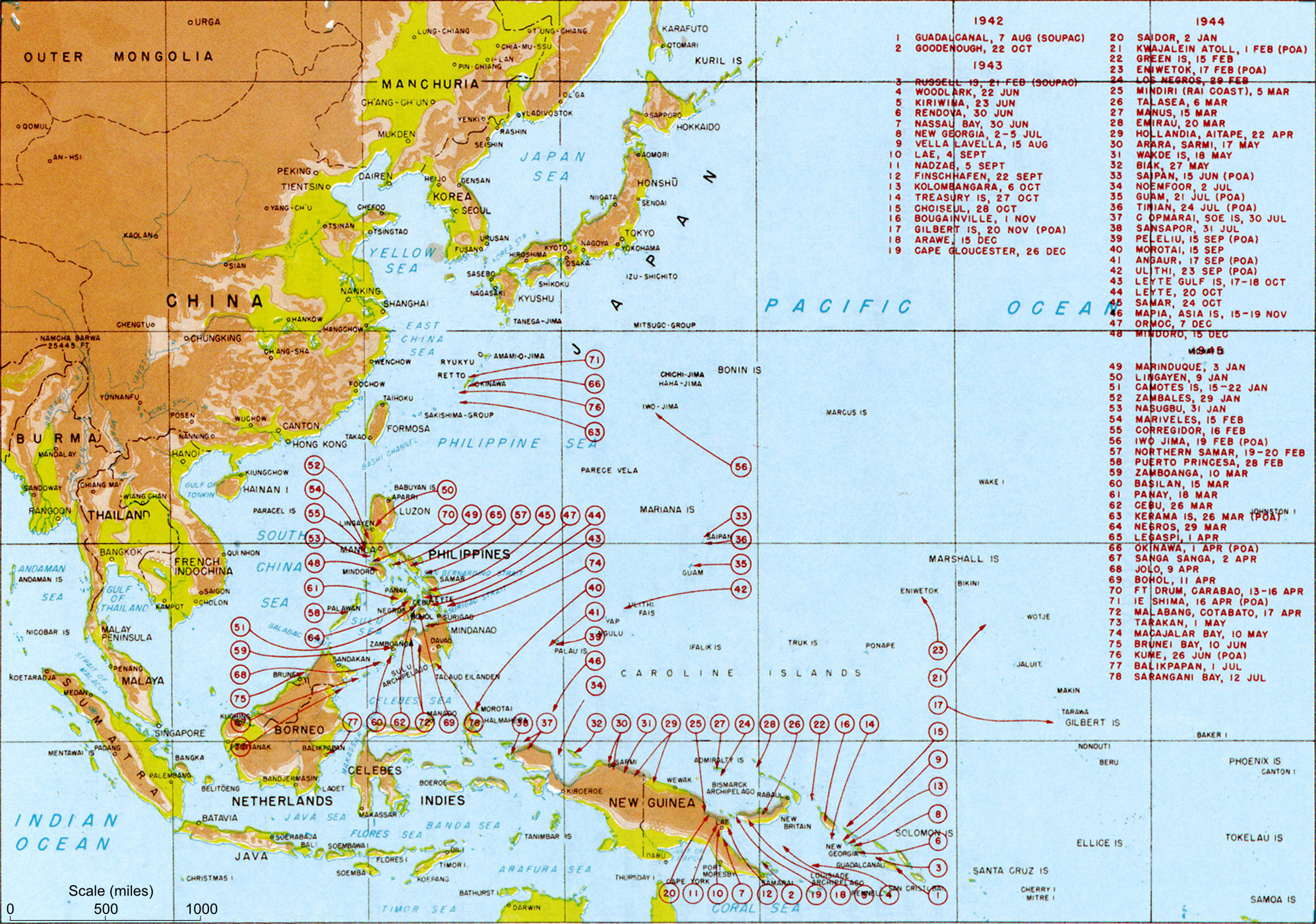
Map titled "Allied landings — August 1942 to August 1945", plate #126. It should be noted that while the title of the image is "US Landings" the map also indicates the position of many landings by Australian troops (at least) so should be referred to as "Allied landings".
Licencja:
Public domain
Komentarz do licencji:
Ta grafika została utworzona przez pracownika Sił Zbrojnych lub Departamentu Obrony Stanów Zjednoczonych podczas wykonywania czynności służbowych. Jako utwór Rządu Federalnego Stanów Zjednoczonych, grafika ta znajduje się w domenie publicznej.
Więcej informacji o licencji można znaleźć tutaj. Ostatnia aktualizacja: Wed, 28 Dec 2022 19:18:51 GMT