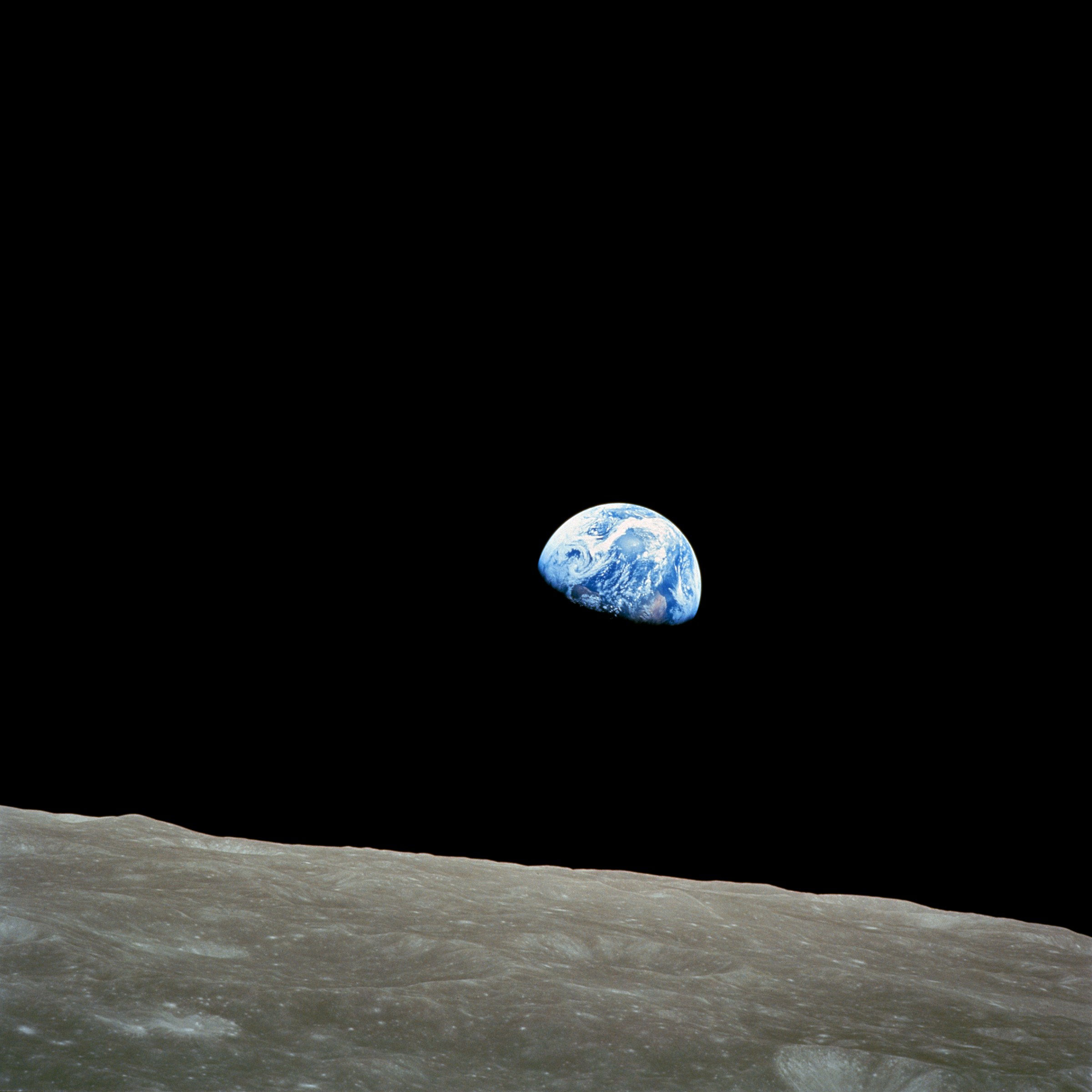
Earthrise
Earthrise
Autor:
NASA/Bill Anders
Krótki link:
źródło:
Wymiary:
2400 x 2400 Pixel (967848 Bytes)
Opis:
Taken by Apollo 8 crewmember Bill Anders on December 24, 1968, at mission time 075:49:07 [8] (16:40 UTC), while in orbit around the Moon, showing the Earth rising for the third time above the lunar horizon. The lunar horizon is approximately 780 kilometers from the spacecraft. Width of the photographed area at the lunar horizon is about 175 kilometers. [9] The land mass visible just above the terminator line is west Africa. Note that this phenomenon is only visible to an observer in motion relative to the lunar surface. Because of the Moon's synchronous rotation relative to the Earth (i.e., the same side of the Moon is always facing Earth), the Earth appears to be stationary (measured in anything less than a geological timescale) in the lunar "sky". In order to observe the effect of Earth rising or setting over the Moon's horizon, an observer must travel towards or away from the point on the lunar surface where the Earth is most directly overhead (centred in the sky). Otherwise, the Earth's apparent motion/visible change will be limited to: 1. Growing larger/smaller as the orbital distance between the two bodies changes. 2. Slight apparent movement of the Earth due to the eccenticity of the Moon's orbit, the effect being called libration. 3. Rotation of the Earth (the Moon's rotation is synchronous relative to the Earth, the Earth's rotation is not synchronous relative to the Moon). 4. Atmospheric & surface changes on Earth (i.e.: weather patterns, changing seasons, etc.). Two craters, visible on the image were named 8 Homeward and Anders' Earthrise in honor of Apollo 8 by IAU in 2018. [10]
Licencja:
Public domain
Więcej informacji o licencji można znaleźć tutaj. Ostatnia aktualizacja: Sat, 24 Dec 2022 14:55:35 GMT