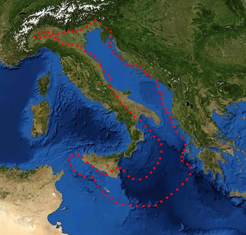
Adriatic Plate
Autor:
- Mediterranian_Sea_16.61811E_38.99124N.jpg: of the modification : Eric Gaba (Sting)
- derivative work: דקי (talk) 17:52, 29 December 2011 (UTC)
Credit:
Mediterranian_Sea_16.61811E_38.99124N.jpg
(July 2012). "Present kinematics of Central and Northern Italy from continuous GPS measurements". Journal of Geodynamics 58: 62-72. Elsevier. ISSN 0264-3707. Retrieved on 12 March 2012.
plate boundary map preview
(July 2012). "Present kinematics of Central and Northern Italy from continuous GPS measurements". Journal of Geodynamics 58: 62-72. Elsevier. ISSN 0264-3707. Retrieved on 12 March 2012.
plate boundary map preview
Krótki link:
źródło:
Wymiary:
817 x 783 Pixel (184885 Bytes)
Opis:
boundaries of the Adriatic plate
Licencja:
Public domain
Więcej informacji o licencji można znaleźć tutaj. Ostatnia aktualizacja: Sun, 11 Dec 2022 17:00:53 GMT