Ammanford
| Ten artykuł od 2011-11 wymaga zweryfikowania podanych informacji. |
(c) Nigel Davies, CC BY-SA 2.0 | |
| Państwo | |
|---|---|
| Księstwo | |
| Hrabstwo | |
| Populacja (2001) • liczba ludności |
|
| Kod pocztowy | SA18 |
Położenie na mapie Carmarthenshire Contains Ordnance Survey data © Crown copyright and database right, CC BY-SA 3.0 | |
Położenie na mapie Wielkiej Brytanii (c) Karte: NordNordWest, Lizenz: Creative Commons by-sa-3.0 de | |
| Strona internetowa | |
| Portal | |
Ammanford (wal. Rhydaman) – miasto w Walii położone w hrabstwie Carmarthenshire, u zbiegu rzek Loughor, Amman i Lash. Populacja: 5 299 mieszkańców (według spisu z 2001 roku), w tym ponad 75% ludności walijskojęzycznej.
Powstanie osadnictwa oraz dalszy rozwój miasta ściśle wiąże się z rozwojem wydobycia węgla kamiennego w okolicach Ammanford w XIX i XX wieku. Nazwę nadano miastu w roku 1880. W drugiej połowie lat 70. XX wieku okoliczne kopalnie zamknięto. Obecnie Ammanford stanowi głównie centrum handlowo-usługowe dla okolicznych wsi.
Media użyte na tej stronie
(c) Karte: NordNordWest, Lizenz: Creative Commons by-sa-3.0 de
Location map of the United Kingdom
(c) Nigel Davies, CC BY-SA 2.0
Quay Street, Ammanford (Recreated) Looking north up Quay St, from near the junction with Hall St and angled towards the east side.
This is a recreation of the 1965 photo at Frith: http://www.francisfrith.com/search/wales/dyfed/ammanford/photos/ammanford_A186091.htm
The street is now pedestrianised, and the terraced red brick buildings in the extreme distance have had their pinnacled dormer windows removed when the roof was replaced.Autor: NordNordWest, Licencja: CC BY-SA 3.0
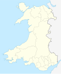
Location map of Wales, United Kingdom
Contains Ordnance Survey data © Crown copyright and database right, CC BY-SA 3.0
Blank map of Carmarthenshire, UK with the following information shown:
- Administrative borders
- Coastline, lakes and rivers
- Roads and railways
- Urban areas
Equirectangular map projection on WGS 84 datum, with N/S stretched 160%
Geographic limits:
- West: 4.75W
- East: 3.58W
- North: 52.15N
- South: 51.58N


