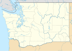
Friday Harbor
 | |
| Państwo | |
|---|---|
| Stan | |
| Populacja (2000) • liczba ludności | 1989 |
| Nr kierunkowy | 360 |
| Kod pocztowy | 98250 |
| Strona internetowa | |
| Portal | |
Friday Harbor – miasto na wyspie San Juan, główne centrum administracyjno-handlowe wysp San Juan, stolica Hrabstwa San Juan w amerykańskim stanie Waszyngton. Jest to równocześnie jedyne formalnie zorganizowane miasto w całym hrabstwie.
Geografia
Według United States Census Bureau, miasto Friday Harbor ma powierzchnię 3,7 km², z czego 3,5 km² to ląd, a 0,2 km² to woda. Woda stanowi 4,93% powierzchni miasta. Miasto położone jest nad Zatoką Friday (ang. Friday Harbor). Codzienne połączenie promowe zapewnia łączność ze stałym lądem oraz trzema innymi wyspami.
Historia
Miasto zostało formalnie utworzone 10 lutego 1909 r.
Dane demograficzne
W 2000 roku miasto liczyło 1989 mieszkańców. Struktura rasowa niewiele odbiega od struktury całej wyspy: 92,01% mieszkańców to biali, 0,65% - czarni, 1,31% - ludność rdzenna.
Media użyte na tej stronie
Autor: Uwe Dedering, Licencja: CC BY-SA 3.0
Location map of the USA (without Hawaii and Alaska).
EquiDistantConicProjection:
Central parallel:
* N: 37.0° N
Central meridian:
* E: 96.0° W
Standard parallels:
* 1: 32.0° N
* 2: 42.0° N
Made with Natural Earth. Free vector and raster map data @ naturalearthdata.com.
Formulas for x and y:
x = 50.0 + 124.03149777329222 * ((1.9694462586094064-({{{2}}}* pi / 180))
      * sin(0.6010514667026994 * ({{{3}}} + 96) * pi / 180))
y = 50.0 + 1.6155950752393982 * 124.03149777329222 * 0.02613325650382181
      - 1.6155950752393982  * 124.03149777329222 *
     (1.3236744353715044  - (1.9694462586094064-({{{2}}}* pi / 180))
      * cos(0.6010514667026994 * ({{{3}}} + 96) * pi / 180))
The flag of Navassa Island is simply the United States flag. It does not have a "local" flag or "unofficial" flag; it is an uninhabited island. The version with a profile view was based on Flags of the World and as a fictional design has no status warranting a place on any Wiki. It was made up by a random person with no connection to the island, it has never flown on the island, and it has never received any sort of recognition or validation by any authority. The person quoted on that page has no authority to bestow a flag, "unofficial" or otherwise, on the island.
Autor: Alexrk2, Licencja: CC BY 3.0
Ta mapa została stworzona za pomocą GeoTools.
Autor: Konrad Roeder, Licencja: CC BY-SA 2.5
San Juan County Courthouse, Friday Harbor, Washington. Designed by Seattle architect William P. White and built in 1906.
An aerial view of Friday Harbor, on San Juan Island, Washington. Shot from about 400' AGL, looking east.


