Mirošovice
| |||||
 | |||||
| Państwo | |||||
| Powierzchnia | 537 ha[1] km² | ||||
| Wysokość | 394[1] m n.p.m. | ||||
| Populacja (2016) • liczba ludności | 1322 | ||||
| Kod pocztowy | 251 66 | ||||
| Tablice rejestracyjne | PH | ||||
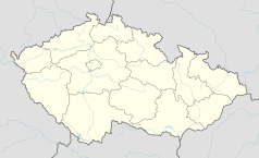
Położenie na mapie Czech (c) Karte: NordNordWest, Lizenz: Creative Commons by-sa-3.0 de | |||||
| Strona internetowa | |||||
| Portal | |||||
Mirošovice - miejscowość w okolicach Pragi w Czechach w kraju środkowoczeskim. Liczy 1322 mieszkańców (2016)[2].
Przypisy
- ↑ a b Obec Mirošovice. [dostęp 2017-12-19].
- ↑ Počet obyvatel v obcích - k 1.1.2017. W: Czeski Urząd Statystyczny [on-line]. [dostęp 2017-12-16].
Media użyte na tej stronie
Czech Republic adm location map.svg
(c) Karte: NordNordWest, Lizenz: Creative Commons by-sa-3.0 de
Location map of the Czech Republic
(c) Karte: NordNordWest, Lizenz: Creative Commons by-sa-3.0 de
Location map of the Czech Republic
Mirošovice CoA.png
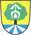
Coat of arms of Mirošovice, Prague-East District, Czech Republic.
Coat of arms of Mirošovice, Prague-East District, Czech Republic.
Mirosovice PH CZ Ke Mlejnu and Senohrabska streets towards N 035.jpg
Mirošovice, Prague-East District, Czech Republic. A view from Ke Mlejnu street through Senohrabská street towards north. Bridge over the Kunický potok stream is also visible.
Mirošovice, Prague-East District, Czech Republic. A view from Ke Mlejnu street through Senohrabská street towards north. Bridge over the Kunický potok stream is also visible.
Mirošovice Flag.png
Flag of Mirošovice, Prague-East District, Czech Republic.
Flag of Mirošovice, Prague-East District, Czech Republic.


