Newton Mearns
(c) Stephen Sweeney, CC BY-SA 2.0 Zabudowa mieszkalna w Newton Mearns | |
| Państwo | |
|---|---|
| Kraj | |
| Hrabstwo | |
| Populacja (2011) • liczba ludności |
|
| Nr kierunkowy | 0141 |
Położenie na mapie East Renfrewshire Contains Ordnance Survey data © Crown copyright and database right, CC BY-SA 3.0 | |
Położenie na mapie Wielkiej Brytanii (c) Karte: NordNordWest, Lizenz: Creative Commons by-sa-3.0 de | |
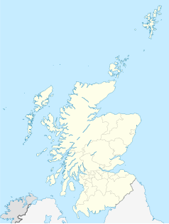
Położenie na mapie Szkocji | |
| Portal | |
Newton Mearns (gael. Baile Ùr na Maoirne[2]) – miasto w środkowej Szkocji, w hrabstwie East Renfrewshire, położone na południowo-zachodnim obrzeżu aglomeracji Glasgow. W 2011 roku liczyło 24 234 mieszkańców[1].
W 1887 roku Newton Mearns było niewielką wsią, liczącą 900 mieszkańców[3]. Miejscowość rozrosła się w XX wieku i stanowi współcześnie zamożne, mieszkalne przedmieście Glasgow[4].
We wschodniej części miasta znajduje się XV-wieczna wieża rycerska Mearns Castle[5].
Przypisy
- ↑ a b Area Profiles: Newton Mearns. [w:] Census Data Explorer [on-line]. Scotland's Census. [dostęp 2019-07-14]. (ang.).
- ↑ Newton Mearns. Ainmean-Àite na h-Alba – Gaelic Place-names of Scotland. [dostęp 2019-07-14]. (ang.).
- ↑ Newton Mearns, Renfrewshire. A vision of Britain through time. [dostęp 2019-07-14]. (ang.).
- ↑ Beverley Brown: The voice of property. The Herald, 2019-01-19. [dostęp 2019-07-14]. (ang.).
- ↑ Plantagenet Somerset Fry: Castles: England, Scotland, Wales, Ireland: the definitive guide to the most impressive buildings and intriguing sites. David & Charles, 2005, s. 156. ISBN 0-7153-2212-5. (ang.).
Media użyte na tej stronie
(c) Karte: NordNordWest, Lizenz: Creative Commons by-sa-3.0 de
Location map of the United Kingdom
Contains Ordnance Survey data © Crown copyright and database right, CC BY-SA 3.0
Blank map of East Renfrewshire, UK with the following information shown:
- Administrative borders
- Coastline, lakes and rivers
- Roads and railways
- Urban areas
Equirectangular map projection on WGS 84 datum, with N/S stretched 175%
Geographic limits:
- West: 4.57W
- East: 4.20W
- North: 55.83N
- South: 55.63N
(c) Stephen Sweeney, CC BY-SA 2.0
Paidmyre Road, Newton Mearns Residential area in the south of the town.
(c) Eric Gaba, NordNordWest, CC BY-SA 3.0
Location map of Scotland, United Kingdom


