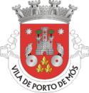
Porto de Mós
| gmina | |||||
 | |||||
| Państwo | |||||
|---|---|---|---|---|---|
| Dystrykt | |||||
| Kraina historyczna | |||||
| Region (NUTS 2) | |||||
| Podregion (NUTS 3) | Pinhal Litoral | ||||
| Powierzchnia | 264,88 km² | ||||
| Populacja (2011) • liczba ludności |
| ||||
| • gęstość | 91,9 os./km² | ||||
| Szczegółowy podział administracyjny | |||||
| Liczba sołectw | 13 | ||||
Położenie na mapie Portugalii | |||||
Porto de Mós – miejscowość w Portugalii, leżąca w dystrykcie Leiria, w regionie Centrum w podregionie Pinhal Litoral. Miejscowość jest siedzibą gminy o tej samej nazwie.
Demografia
| Liczba ludności gminy Porto de Mós (1801–2011) | |||||||||
|---|---|---|---|---|---|---|---|---|---|
| 1801 | 1849 | 1900 | 1930 | 1960 | 1981 | 1991 | 2001 | 2004 | 2011 |
| 10 742 | 9 801 | 12 554 | 16 296 | 21 220 | 21 700 | 23 343 | 24 271 | 24 775 | 24 342[1] |
Sołectwa
Sołectwa gminy Porto de Mós (ludność wg stanu na 2011 r.)[1]
- Alcaria - 244 osoby
- Alqueidão da Serra - 1755 osób
- Alvados - 497 osób
- Arrimal - 774 osoby
- Calvaria de Cima - 2462 osoby
- Juncal - 3316 osób
- Mendiga - 930 osób
- Mira de Aire - 3775 osób
- Pedreiras - 2705 osób
- São Bento - 835 osób
- São João Baptista - 3144 osoby
- São Pedro - 2879 osób
- Serro Ventoso - 1026 osób
Przypisy
- ↑ a b c Statistics Portugal, www.ine.pt [dostęp 2018-02-11] (ang.).
Media użyte na tej stronie
Flag of Portugal, created by Columbano Bordalo Pinheiro (1857-1929), officially adopted by Portuguese government in June 30th 1911 (in use since about November 1910). Color shades matching the RGB values officially reccomended here. (PMS values should be used for direct ink or textile; CMYK for 4-color offset printing on paper; this is an image for screen display, RGB should be used.)
Autor: Vitor Oliveira from Torres Vedras, PORTUGAL, Licencja: CC BY 2.0
A fotografia está meio manhosa, mas o castelo é muito bonito.


