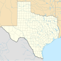
Anna (Teksas)
| ||
 | ||
| Państwo | ||
| Stan | ||
| Hrabstwo | Collin | |
| Data założenia | 1883 | |
| Prawa miejskie | 1913 | |
| Kod statystyczny | FIPS: 48-03300 GNIS ID: 1351131 | |
| Powierzchnia | 4,3 km² | |
| Wysokość | 217 m n.p.m. | |
| Populacja (2010) • liczba ludności • gęstość | 8 249 1918,4 os./km² | |
| Nr kierunkowy | 972 | |
| Kod pocztowy | 75409[1] | |
| Strefa czasowa | UTC-06:00 UTC-05:00 | |
| Strona internetowa | ||
| Portal | ||
Anna – miasto w Stanach Zjednoczonych, w stanie Teksas, w hrabstwie Collin.
Na miejscu obecnego miasta w 1872 roku stworzono przystanek kolejowy, dziesięć lat później w jego okolicach mieszkało dwadzieścia osób. Rok później powstał tam oddział pocztowy, a prawa miejskie zostały przyznane w 1913 roku[2][3].
Demografia
Według przeprowadzonego przez United States Census Bureau spisu powszechnego w 2010 roku miasto liczyło 8 249 mieszkańców. Natomiast skład etniczny w mieście wyglądał następująco: Biali 78,4%, Afroamerykanie 7,7%, Azjaci 0,8%, pozostali 13,1%[4].
Przypisy
- ↑ Look Up a ZIP Code (ang.). United States Postal Service. [dostęp 2014-01-01].
- ↑ A Town Named Anna (ang.). annatexas.gov. [dostęp 2014-01-01].
- ↑ Anna History (ang.). annatexas.gov. [dostęp 2014-01-01].
- ↑ factfinder.census.gov (ang.). United States Census Bureau. [dostęp 2014-01-01].
Linki zewnętrzne
Media użyte na tej stronie
Autor: Uwe Dedering, Licencja: CC BY-SA 3.0
Location map of the USA (without Hawaii and Alaska).
EquiDistantConicProjection:
Central parallel:
* N: 37.0° N
Central meridian:
* E: 96.0° W
Standard parallels:
* 1: 32.0° N
* 2: 42.0° N
Made with Natural Earth. Free vector and raster map data @ naturalearthdata.com.
Formulas for x and y:
x = 50.0 + 124.03149777329222 * ((1.9694462586094064-({{{2}}}* pi / 180))
      * sin(0.6010514667026994 * ({{{3}}} + 96) * pi / 180))
y = 50.0 + 1.6155950752393982 * 124.03149777329222 * 0.02613325650382181
      - 1.6155950752393982  * 124.03149777329222 *
     (1.3236744353715044  - (1.9694462586094064-({{{2}}}* pi / 180))
      * cos(0.6010514667026994 * ({{{3}}} + 96) * pi / 180))
The flag of Navassa Island is simply the United States flag. It does not have a "local" flag or "unofficial" flag; it is an uninhabited island. The version with a profile view was based on Flags of the World and as a fictional design has no status warranting a place on any Wiki. It was made up by a random person with no connection to the island, it has never flown on the island, and it has never received any sort of recognition or validation by any authority. The person quoted on that page has no authority to bestow a flag, "unofficial" or otherwise, on the island.
Autor: Alexrk, Licencja: CC BY 3.0
Ta mapa została stworzona za pomocą GeoTools.
Autor: Ebmrreditor, Licencja: CC BY-SA 4.0
Liberty Christian Church (Disciples of Christ), one of the earliest Christian Churches in Texas, was founded in northern Collin County by pioneer settlers Collin McKinney and J.B. Wilmeth in 1846. In 1854 a Christian seminary was established by members of the Liberty congregation about two miles northwest of Anna in the (then) newly established community of Mantua.


